Survey objective: precise mapping of drainage and soil conditions
Across several Finnish municipalities, the Maa-Akatemia (Soil/Land Academy) team studied how water moves through farmland and how soil structure influences it. Their goal was to give farmers and local authorities clear maps showing the condition of drainage systems and soil health — two key parts of productive, regenerative farming.
In the field, they looked at how well water drained after rain, how compact the soil was, and how easily roots could grow. When these systems work properly, they keep nutrients out of rivers, store more carbon, create better growing conditions, and make yields more stable.
Many drainage systems built in the 1940s–1980s are now buried or misplaced. Due to little maintenance, they are often misplaced or hidden under the soil. To locate old infrastructure, a key requirement was centimeter-level precision in locating drainage outlets.
Mapping workflow for soil and water cycle assessment
Preparation and software
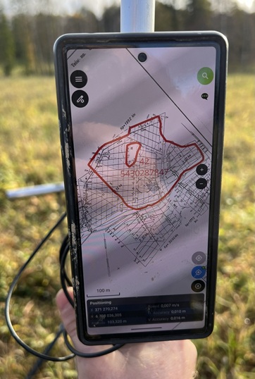
Before going to the field, the team digitized old drainage maps and matched them with modern satellite imagery in QGIS. They built a digital survey form to record notes, photos, and audio directly in the field, and synced everything through QFieldCloud to the QField mobile app — so everyone could work with the same live data.
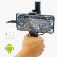
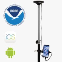
Hardware: building a survey tool
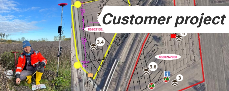
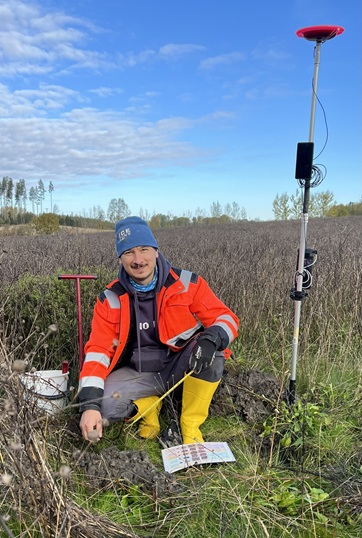
Instead of using expensive surveying equipment, the team built their own DIY survey kit. It combined an RTK Portable Bluetooth Kit and a 15 000 mAh power bank, all mounted on a pole with simple bicycle phone holders. This setup gave them centimeter-level accuracy at a fraction of the usual cost.
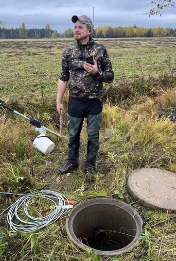
Field data collection
Using RTK kit and QField app in the field, the team navigated to potential drainage outlets and wells. Each location was logged with centimeter precision, along with photos and field notes that were instantly uploaded to the cloud. This allowed the data to be reviewed and processed almost in real time back at the office.
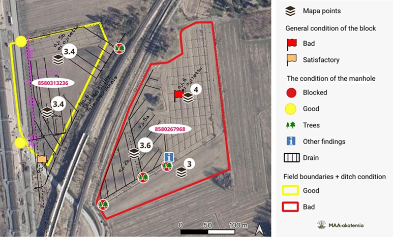
Results and impact of precise drainage system
By the end of the project, the Maa-Akatemia team had mapped over 70 fields, covering about 300 hectares. They created a clear visual report using a “streetlight” classification (🟢 good, 🟠 acceptable, 🔴 poor). This dataset now helps guide their decision-making and plan future fieldwork. The observations included detailed assessments of drainage system and ditch conditions, soil structure in the first 35 cm, soil permeability down to 1.2 m.
The resulting dataset now serves as a practical planning tool for local authorities and farmers — helping them restore water flow, improve soil health, and make regeneration work measurable and visible.
 and
and