and
and 
RTK Applications: Survey and Mapping
The surveying industry has been using surveying technique that uses a real-time kinematic GPS/GNSS RTK receiver to provide centimeter or millimeter level accuracy for more than 15 years to collect data for precise mapping.
Few decades ago high-precision devices cost fabulous money. Since that RTK technology has become more popular in recent years with the increased use of GPS, leading chip manufacturers have found a solution to produce affordable modules that give the same accuracy as high-end ones.
This allowed to decrease cost of the receivers. So that RTK surveying technology became affordable and available to customers while keeping the same high level accuracy. Read more about Field test evaluation of the affordable Ardusimple simpleRTK2Blite Starter kit operating in RTK mode.
There are several examples of application GNSS RTK technology in surveying and mapping:
Cadastral and Land Survey
If you need to calculate the coordinates of a plot, to make topographic plans and maps, to stake out markers and reference points, you need centimeter positioning accuracy.
Are you planning to divide a plot of the land?
Do you want to check that the neighbor’s new fence is in the right place?
Do you need to overlay an area with complex geometry on Google map? Or visualise real-time data in Google Earth?
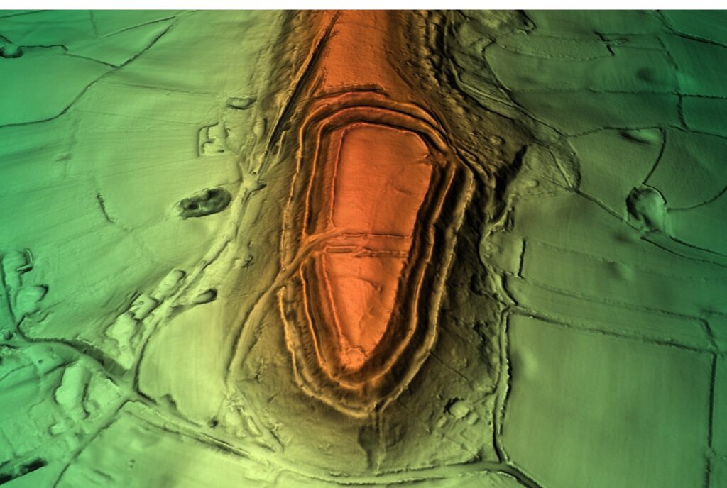
Archaeological survey, Mapping of Historical and Cultural places
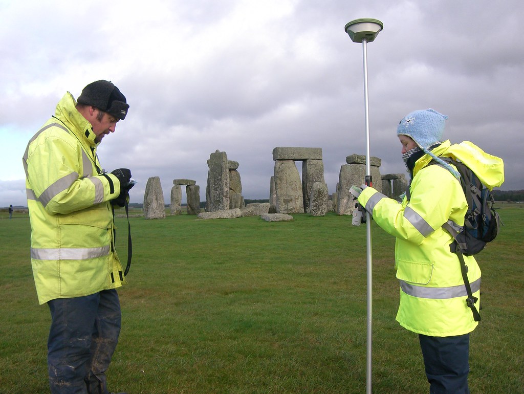
If you want to map points of archaeological work and interesting finds, ArduSimple Professional kits will speed up this work and will do it accuratly. RTK Handheld Surveyor Kit is useful when you need portable survey performance that fits on your hand. Get started with the How to use Ardusimple products with Android smartphones/tablets.
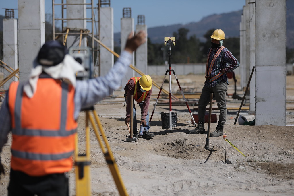
Construction and Engineering Survey
Surveying engineers are typically employed in the construction industry.Staking out markers and reference points must be taken to ensure that construction work is carried out in accordance with approved design plans.
Do you need to stake out markers and control points on the construction site to tell contractors where to start building a new structure according to the design documentation?
Is it needed to establish the position and alignment of bridges, highways, buildings and other man-made objects?
All these tasks can be solved by professional surveyors with the help of RTK Calibrated Surveyor Kit or Base-Rover Surveyor Kit.
Learn how to export your survey work from your Android device to QGIS and AutoCAD.
Construction Staking
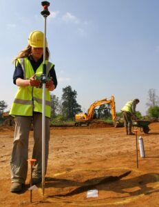
Construction staking is the process of taking planned improvements and buildings, and then actually mapping them out on the site where the building will take place. It plays a vital role in helping an organization make the leap from plans and blueprints to actual construction work.
Construction staking with ArduSimple Professional kits will allow you to follow the blueprint, keep projects on track, create efficiency and effectiveness, save time and money on jobs, monitor project progress, make changes and adjustments.
We have prepared a tutorial how to export your Android device surveying project created with SW Maps, Mapit GIS or Mapit Spatial to QGIS and AutoCAD.
Digital elevation modeling
For some cases you may need to use a high quality orthometric height (height above mean sea level) measurement in real time with your Android smartphone or tablet. In this tutorial we will explain step by step how to do it.
Forensic mapping
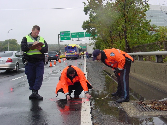
Forensic mapping using GPS/GNSS RTK technology to document physical evidence at some critical incident, much like the physical evidence at the scene of highway crashes for years have been documented and greatly speeds up the mapping.
If you need to do a map for criminal, crash, advanced fire and explosion investigation, crash reconstruction, high precision ArduSimple Professional kits will speed up you. You can follow here the Unboxing guide for assembling your RTK Calibrated Surveyor Kit from ArduSimple and Mock location with USB OTG.
Geotagging
Geo-tagging images also makes it easier to photo-merge the many pictures taken during a camera mission. Do you need to take photos at certain points of your route? Just point out locations in your mission planner. ArduSimple Starter kits and Professinal kits will provide you precise data.
Contact us and we will help you to find a right product for you GNSS/RTK project, we always answer within 24 hours.
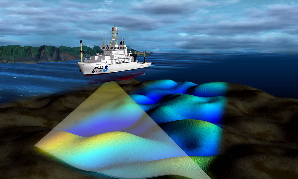
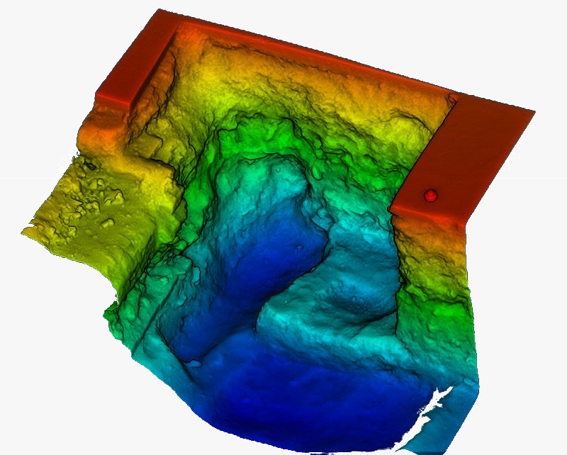
Hydrographic Survey
Vessels involved in deep-water drilling are expensive assets to operate. Sustained accurate positioning forms a critical component in what they do. Downtime and any other result of interruption or inaccuracy are extremely costly.
Sustained accurate positioning forms a critical component in what they do positioning solutions that are critical for all these operations.
You may need to measure orthometric height, so we prepared a tutorial how to use a high quality orthometric height measurement in real time with your Android smartphone or tablet.
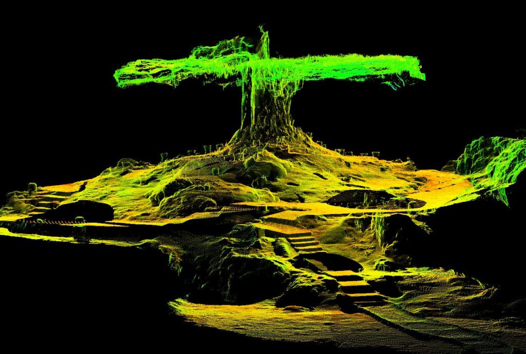
Lidar Mapping
The minimum lidar classification involves detecting the lidar points that represent the ground. More advanced classifications involve determining if the points represent vegetation, building or power lines etc.
Once the lidar is classified, the points are converted into a continuous surface model that can be colourized and have artificial sun shading applied to enhance the relief.
Do you manufacture equipment capable of doing LiDar shooting of clouds or exploring the atmosphere, monitoring the rate of iceberg melting and land erosion? ArduSimple Starter kits are capable for that, contact us and we will find a right solution.
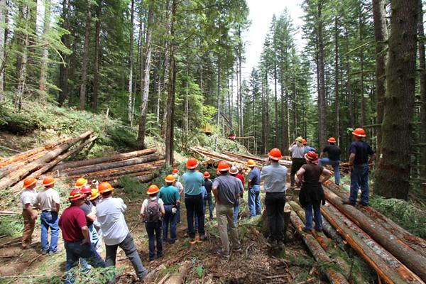
Mapping
Is it needed to map forest trails in your forestry?
Do you want to map the route of your hike with children in the mountains or do Ski turn analysis with RTK GPS?
Do you need to monitor and detect any movement of buildings, structures, earthworks, slopes, or even measure ground settlement before a construction work with centimeter precision?
Are you responsible for sustainable forest management activities that include hunting and forest health monitoring
If you want to develop your own device for mapping (like PocketLocator – Ultracompact RTK receiver for pole mount made in Denmark) explore ArdiuSimple Starter kits.
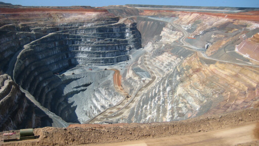
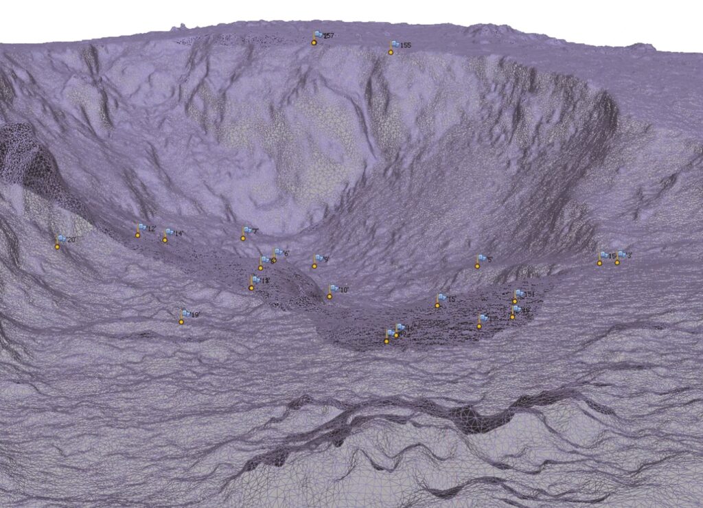
Mine Survey
Mining surveyors are involved in the planning, construction and operation of various types of mines. These mines may be open cut or underground.
Each of these types of mining requires specialized input by a skilled mining surveyor.
Activities of a mining surveyor can include setting out of drill patterns, excavations and conveyors, locating underground roadways and voids, taking of measurements for volume calculations, monitoring of ground movement, land management and preparing statutory mine plans with the help of high precision positioning equipment such as RTK Calibrated Surveyor Kit or Base-Rover Surveyor Kit.
In this tutorial we explained how to configure Ardusimple RTK receivers to be used as mock location for Android smartphones/tablets in order to get centimeter position accuracy.
Photogrammetry
Do you need to compose a visualize digital terrain model?
Do you want to create an interactive 3D virtual reality tour?
Are you an architect and you need to reconstruct or restore a building?
With the help of photogrammetry the desired object is photographed, and then identical points are identified from adjacent images and their position is determined in the coordinates of the base image. The points are added together on imaginary frames, and a finished model is obtained. Our pre-configured Starter Kits is a minimum set of items needed to start your project.
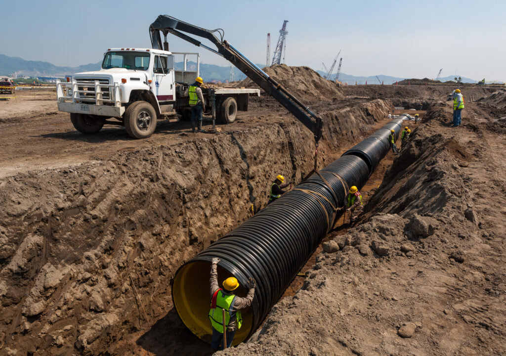
Pipeline and Cable installation monitoring
A similar case is when you want to map the communication cables that lead to your house so that you can use them in the future if repairs are needed.
High precise positioning is useful for extensive research in areas like preliminary, land issues, clearing, construction, restoration and environmental for forecasting research and future reference.
Topographic Survey
You can choose ArduSimple Starter Kits or just contact us and we will help you to find a right product, we always answer within 24 hours.
Check tutorial how to Visualise GNSS RTK real-time data in Google Earth.
3D Survey
It is a non-invasive technology that captures a set of data points (the point cloud) and maps them on a grid coordinate of x, y and z.
If it is your case, explore ArduSimple Starter Kits or just contact us, we provide support and advice to every customer!