How to use custom geoid for orthometric height measurements in Android with Mapit GIS or Mapit Spatial
For some applications you may need to use a high quality orthometric height (height above mean sea level) measurement in real time. In orthometric height, planet earth shape at sea level is modelled with high detail (geoid). In this tutorial we will explain step by step how to use a custom geoid for high quality orthometric height measurements with your Android smart phone or tablet.
Required hardware:
RTK Calibrated Surveyor Kit (we use this product because it gives accurate height measurement thanks to its pole, you can also use your preferred RTK receiver)
Geoid Converter from Eye4Software for computer (you can download it from their site or directly from here)
Custom geoid in any of the following formats:
Eye4Software Geoid File Format (GEO Files)
Trimble Geoid File Format (GGF Files)
Carlson Geoid File Format (GSF Files)
US National Geodetic Survey (NGS) File Format (BIN Files)
Natural Resources Canada Files (BYN Files)
Surfer V6 Binary Grid Files (GRD Files)
NOAA VDATUM grid file (GTX Files)
AusGeoid File Format (Australian Geoids)
French ASCII Geoid Files (MNT Files)
ASCII Geoid Files
How to use a custom geoid for high quality orthometric height measurements with your Android device?
Firstly, prepare the custom geoid.
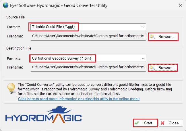
Get the geoid of the area where you plan to do your measurements. You can check the geoid of your area here. In our example, we use the geoid from the Spanish National Geographic Institute. In our case we have the geoid in Trimble format: *.ggf.
We will use Geoid Converter to convert the ggf file into US National Geodetic Survey File Format (BIN Files), so that it can be read in Mapit GIS or Mapit Spatial application.
Run the Geoid Converter on your computer. Select source file format to match our original geoid file format: *.ggf. Click Browse… and select Source File you get in step1. Select destination file format to US National Geodetic Survey (*.bin). Click Browse… and select Destination File name and folder.
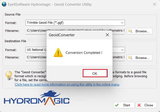
Click Start button and you are done! You will see a window says Conversion Completed! Just press OK.
Copy the .bin file in your Android device in: Internal Memory/Mapit/Resources
Secondly, connect your receiver to Mapit GIS or Mapit Spatial.
Assemble your RTK Calibrated Surveyor Kit and put your antenna in a location with good view of the sky, or near a window for testing the functionality.
Connect your receiver to GNSS Master app, enable mock locations and connect to a NTRIP server to get the best accuracy. If you don’t know how to do it, check this tutorial.
Now your Android device is using external RTK receiver as if it was its internal GPS of your Android device.
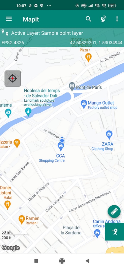
Open Mapit GIS or Mapit Spatial application. By default, it uses the internal GPS which is the RTK Calibrated Surveyor Kit now. You should already see your position on the map.
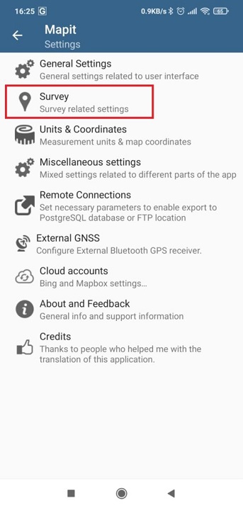
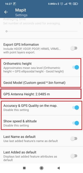
Go to Settings. Select Survey.
Enable the following options:
Orthometric height
Accuracy & GPS Quality on the map
Show speed&altitude
Select geoid model option: Custom geoid *.bin format.
Set the GPS Antenna Height according to your device.
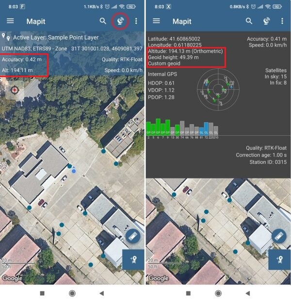
If you go back to the main screen, you will already see the orthometric altitude based on your custom geoid. By clicking on the antenna icon, you’ll see the additional information.
Now you are ready to map and survey in a variety of applications from agriculture and forestry to road construction, geology, land surveying where precise elevation data is required.
If you want to do this tutorial, we have all the products in stock and ready to be shipped:
 and
and  How to get a quotation