 and
and 

RTK Applications: Research and Development
Introduction to R&D use cases

Alpine Ski Racing


Crash Tests

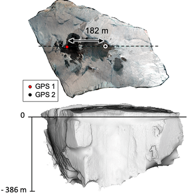
Coastal Terrain Monitoring
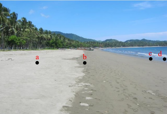
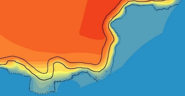
If you engaged in coastal and marine management or inland and marine spatial planning, you can use GNSS RTK technology to determine a coastline form between the land and the ocean which is affected by the tides. With the help of RTK Base-Rover Calibrated Surveyor Kit researches generated coordinates and elevation and use tides values as reference datum. After the above, Digital Elevation Model generated from those points are combined with bathymetry and land elevation data resulting three types of coastlines, namely the lowest, highest and average tides at sea level.
Are you engaged in coastal morphodynamics monitoring? You can do coastal cliff monitoring with the help of RTK GNSS-Assisted Terrestrial Photogrammetry method, that requires a simple frame that mechanically connects a RTK GNSS antenna to the camera. The system is low cost, easy to transport, offers high autonomy and enables saving time during acquisition and data processing. Check our tutorial How to Export your survey work from your Android device to QGIS and AutoCAD.
Earth Movement
Road Lighting Measurements

Your R&D project?


