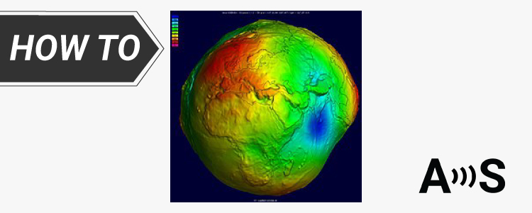
We’ve explained the different types of heights in the tutorial Ellipsoidal, Orthometric, and Geoid heights, and what they mean for your work. When taking ...
Post-Processed Kinematic (PPK) is a positioning technique that involves post-processing of GNSS data after the data collection is completed. PPK solutions have several advantages: ...
Post processed kinematic (PPK) is a GPS correction technology used in surveying that corrects the location data after it is collected and uploaded. The ...
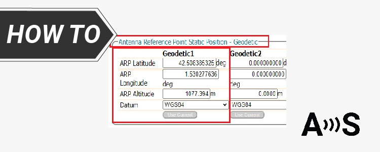
In the previous tutorial on configuring the simpleRTK3B as a static base station, we demonstrated the process of establishing the reference position using Septentrio’s ...
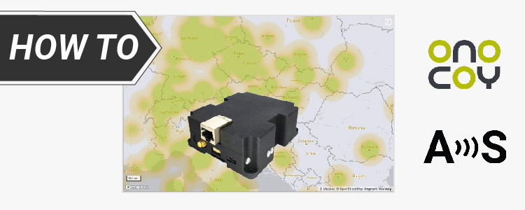
Onocoy is a community-powered GNSS reference station network that provides high-quality RTK reference station data to enable ultra-precise positioning. It ensures a high data ...
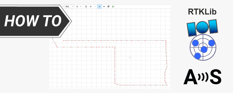
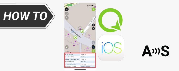
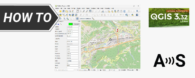
QGIS is a free and open-source desktop geographic information system (GIS) app that provides data viewing, editing, and analysis. It can be used for ...
 and
and  How to get a quotation