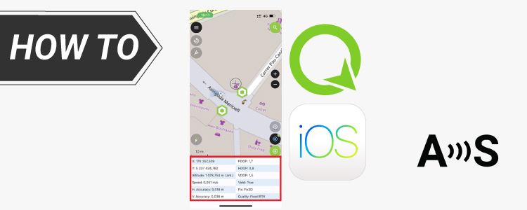
How to connect external GNSS/RTK receiver to QField app on iOS or Android
Table of contents
QField is a mobile mapping and data collection app that works with QGIS. It allows you to collect and edit field data outdoors and sync it easily with QGIS Desktop. QField is available for Android and iOS.
The app is free to use, with optional paid features available depending on your needs. A new built-in NTRIP client has recently been added, making it easier to use RTK corrections directly from QField and achieve centimeter-level positioning accuracy.
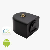
To use QField’s built-in NTRIP client, you can connect it to ArduSimple RTK receivers with Bluetooth Low Energy support, such as the RTK Handheld 2 Mapping Kit, RTK Smart Antenna, RTK Portable 2. Other ArduSimple RTK boards can also be used — simply add the BT+BLE Bridge to connect them wirelessly to your mobile device.
For centimeter-accurate measurements, you must connect to an NTRIP service to receive RTK corrections. If you need assistance finding one, consult our prepared list of RTK correction services in your country.
How to use RTK receiver with QField on Android or iOS
Connect the RTK receiver to your mobile device.
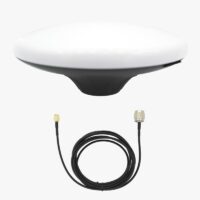
Connect the RTK antenna to your receiver. Place your antenna in a location with a clear non-obstructed sky view, alternatively for testing purposes you may place it near a window.
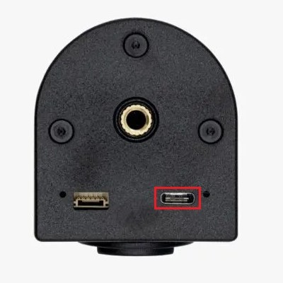
Power your receiver by connecting the USB-C port directly to your mobile device or power bank using the USB-C to USB-C cable.
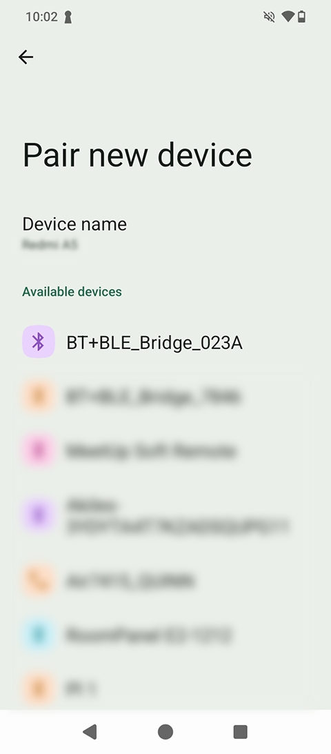
On Android the RTK Portable 2 must be paired as a Bluetooth device in your phone or tablet before using it. Go to Settings -> Connected devices -> Pair new device and look for a device called BT+BLE_Bridge_XXXX, select it and press Pair. Remember that this step is only needed on Android, not for iOS devices.
Connect the external RTK receiver to QField
This tutorial show Android screen captures, but there is no difference with iOS. Please follow the exact same steps on your iOS device.
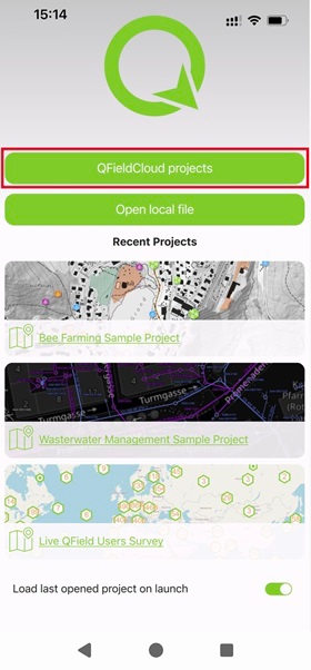
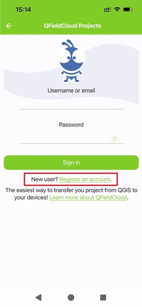
Open QField and login to your QFieldCloud account. If you do not have an account, press QFieldCloud Projects -> Register an account, follow the registration process to create a new cloud project and open it.
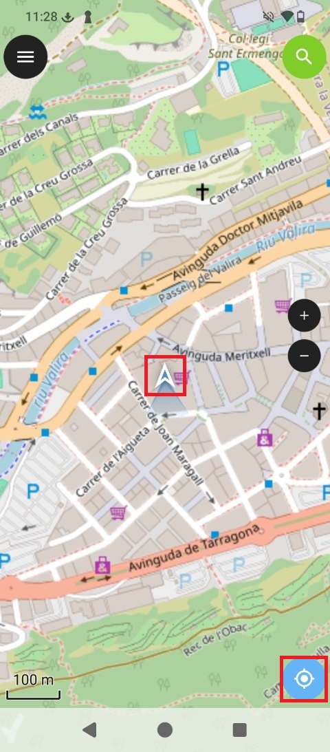
Enable QField location by pressing the icon at the bottom right corner. Your current location (provided by the internal GPS device) will show on the screen.
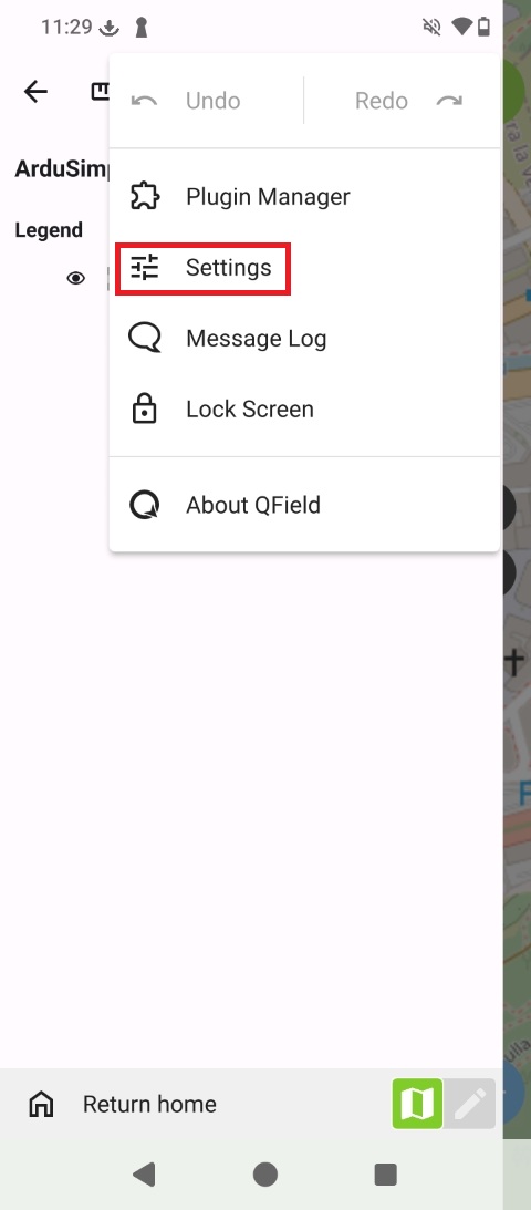
Go to QField Menu -> Settings.
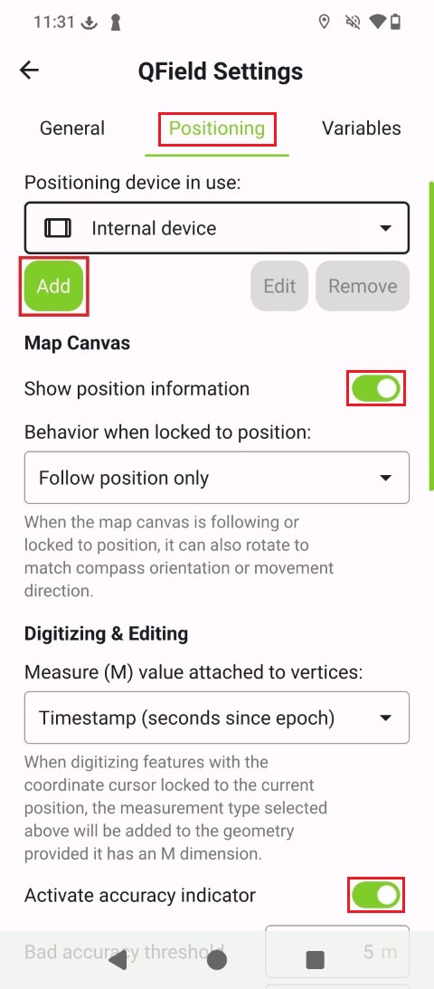
At the Positioning tab activate Show position information and Activate accuracy indicator, and press Add.
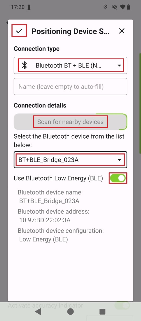
Set Connection type to Bluetooth BT+BLE and press Scan for nearby devices. Your external RTK reciever will appear at the menu below, select the BT+BLE_Bridge_XXXX device you paired on step 3 and activate Use Bluetooth Low Energy (BLE).
Get RTK Corrections using the built-on NTRIP Client
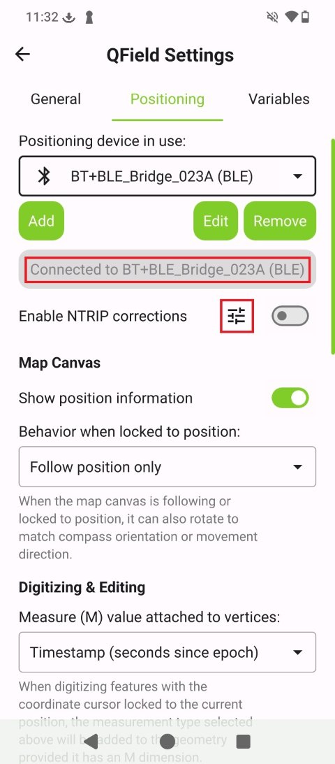
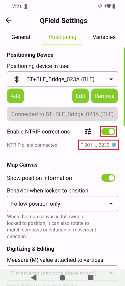
Once connected to BT+BLE Bridge, press the Enable NTRIP corrections options icon.
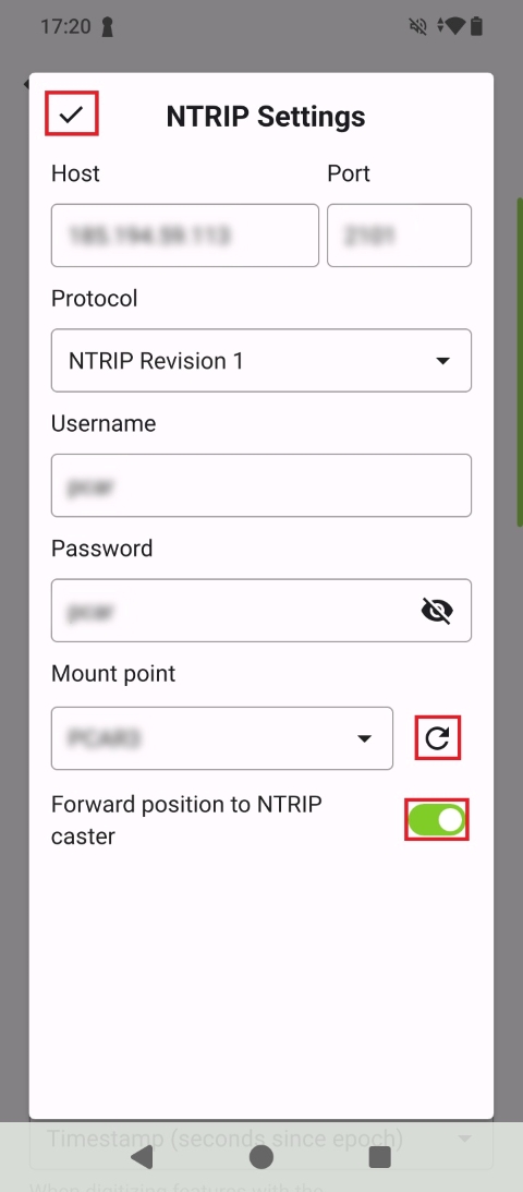
Enter your NTRIP service credentials and press the refresh icon to get the available Mount points, making sure to also activating Fordward position to NTRIP caster.
A successful NTRIP client connection should show data packets being sent and received.
Confirm centimeter-level GPS position accuracy
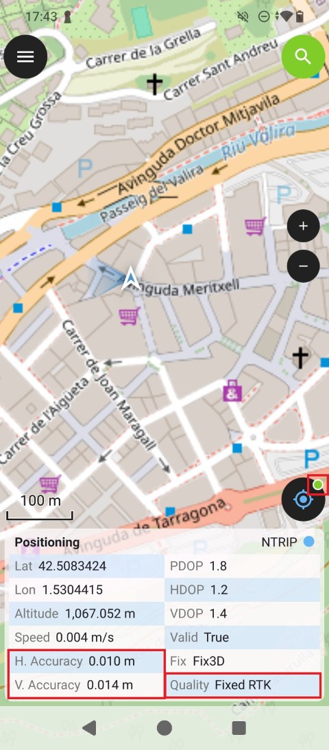
Go back to QField map view, now the position data is provided by the external ArduSimple RTK receiver. After a few seconds, the signal quality should switch to Float/Fixed RTK and centimeter-level accuracy. Note also the location icon badge switching from red to orange/green.
Now you are ready to start your precision task using QField app.
Related products
If you want to follow this tutorial we have all the products in stock and ready to be shipped worldwide within 1-3 days.
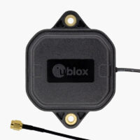

 and
and  How to get a quotation