 and
and 

How GPS can help you measure the real heading of your vehicle?

In the context of GNSS and GPS, we often encounter terms such as heading, course, track, yaw etc. This can be confusing at times because they are frequently (incorrectly) used interchangeably in conversations.
Heading
By definition though, heading determines the direction in which a vehicle, a boat or a plane is facing. In GPS receivers Heading may also be labeled as Yaw, indicating the rotation around vertical axis.
If I have a flight plan to go from A to B, under optimal conditions, the heading direction aligns with the route towards destination B.
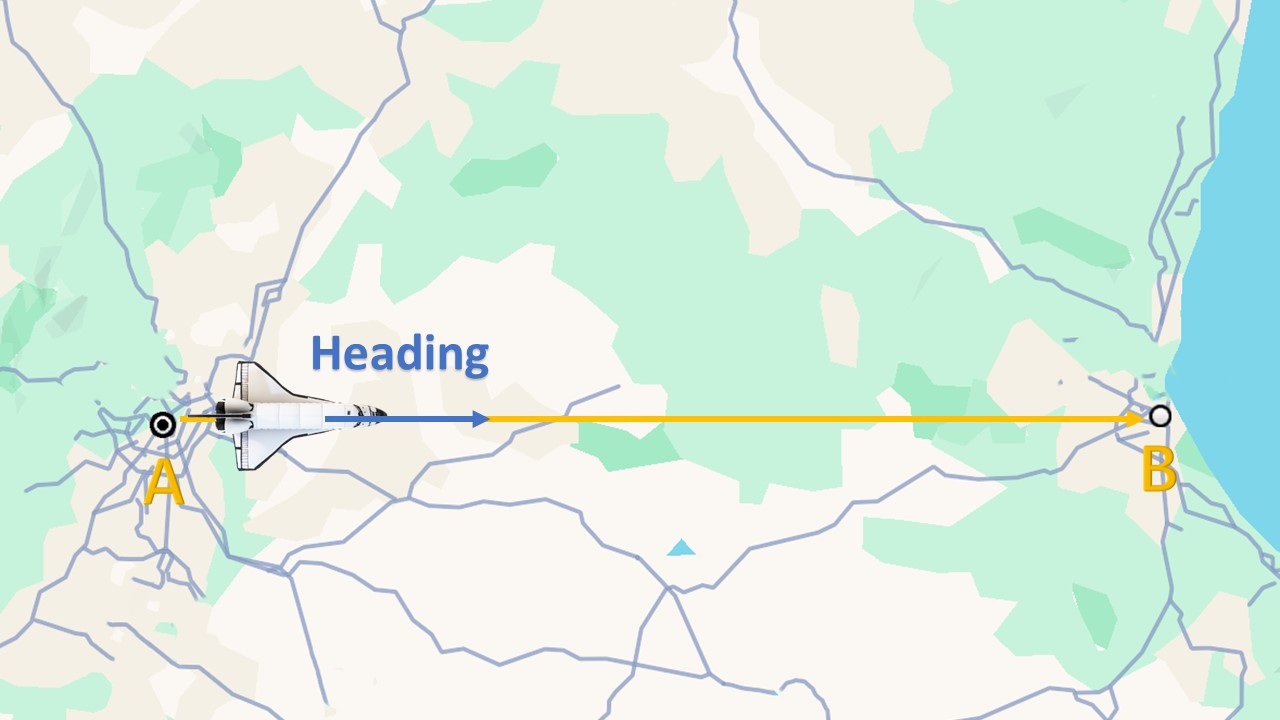
But most of the time there is a wind and the plane will get blown away from the route towards destination. We can composite that by adding our plane a heading of the nose into the wind.

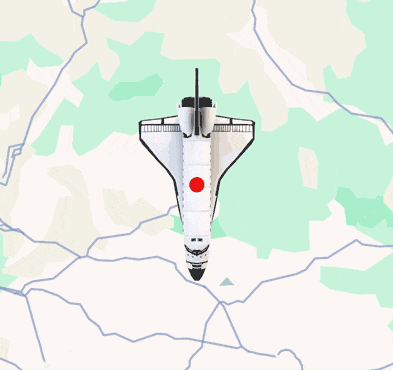
Course over ground
COG is the instantaneous direction of motion at a given point in time. Sometimes it can also be called the heading of motion.
If we supposed that the wind was stronger than expected then the red arrow will show the COG.

Track
Track, often called “track line” or “ground track,” simply refers to the recorded path or the route that an object has taken over time. It is the sequence of positions or points that describe the historical movement of the object.

How to measure Heading and Course Over Ground using GNSS receiver?
A GNSS receiver with single antenna can provide the Course Over Ground by calculating the position over time if the vehicle is moving. However, it is not able to detect the rotational movement of the object if it is static.
A GNSS receiver with dual antenna is one way to provide Heading whether the vehicle is moving or static. GNSS heading can be determined by comparing the position of the two antennas.
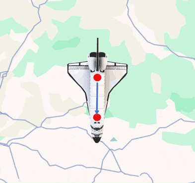
How to place GNSS antennas to obtain accurate heading data?
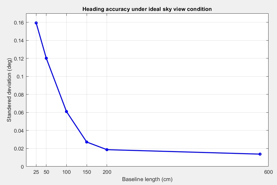
There is a minimum distance required between 2 antennas for an accurate heading to be generated. Heading accuracy can be improved by increasing the baseline length (distance between the 2 antennas).
In general minimum 1 meter distance (baseline length) is required to achieve satisfactory sub-degree precision under non-ideal condition. In practical, this is not possible for many vehicles. With a good installation with 0.5 meters, you can get decent results. With 0.3 meters it’s possible to get heading, but it’s output sometimes will be a bit noisy. But it might be good enough for some applications.
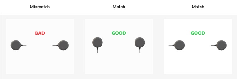
It is recommended that both GNSS antennas be identical and have the same physical orientation relative to each other (i.e. the antenna cable should exit in the same direction on both antennas). This will ensure best RF phase center alignment and heading accuracy. The actual RF phase center is often offset from the physical center of the antenna case.
For optimal results, ensure that the RF cable lengths for both antennas are identical.
The appropriate positioning update rate depends on the application. For example, for a slow-moving object, 1Hz update rate may be sufficient as opposed to 50Hz for a fast moving one.
So that remember the recommendations for better results in GNSS Heading measurements:
- Two antennas should be identical
- Install 2 antennas as far as possible from each other
- Keep the same physical orientation to each other
- The length of the antenna cable should be the same
ArduSimple offers several products to provide Heading:
- simpleRTK2B Heading – Basic Starter Kit , the most affordable option for use cases which do not require high update rates
- simpleRTK3B Heading enable you with up to 50Hz Heading
- simpleRTK2B SBC – Development Kit allows you to reach centimeter level position and subdegree heading accuracy
- find more boards which provide precise position and heading at GPS Compass page.

RTK Assistant
Find the best products for your application in just a few questions.

