
 and
and 

How to connect ArduSimple RTK receivers to QGIS for real time position

On this page
Products used in this tutorial

QGIS is a free and open-source desktop geographic information system (GIS) app that provides data viewing, editing, and analysis. It can be used for almost any GIS application by cartographers, surveyors, foresters, etc… to visualize geographic information.
In this tutorial, we’ll explain step by step how to integrate one of the ArduSimple RTK Professional kits (we use the budget friendly RTK Portable 2) with QGIS, enabling you to obtain real-time geographical position data with centimeter-level accuracy.
Required hardware
- RTK Portable 2
- u-blox ANN-MB-00 Multiband GNSS Antenna
- Windows PC or laptop
Required software
- QGIS
- u-center (for M8, M9, F9)
- Virtual Serial Port emulator (when using u-center)
- GNSS Master app (when using Android Mock location)
How to activate live GPS tracking in QGIS
Connect your receiver to QGIS
- Connect the RTK antenna to your RTK receiver. Place antenna in a location with an unobstructed sky view, or near a window for testing functionality.
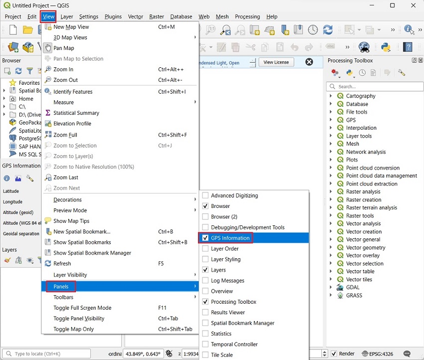
- On a Windows PC or laptop open QGIS. In the toolbar, click on View > Panels > GPS Information. You will get a new docking window on the left side of the canvas.
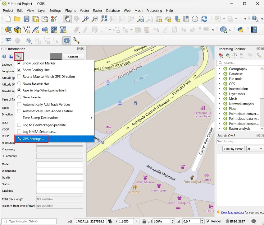
- Click on the wrench icon and go to GPS Settings.
- Now we have to choose the type of connection to the receiver.
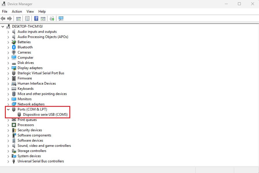
- Open the Windows Device Manager and power the RTK Portable 2 receiver by connecting it to the PC or laptop using the provided USB to USB-C cable. A new COM port will appear in the Ports (COM & LPT) section.
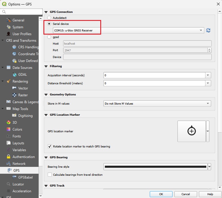
- Select Serial device and choose the COM port that appeared in the previous step, press OK.
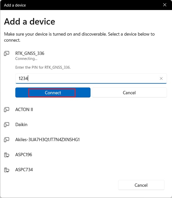
- Power the RTK Portable 2 receiver by connecting it to a power bank and enable Bluetooth on the PC or laptop. Look for the RTK receiver name and pair it using password 1234, if asked.
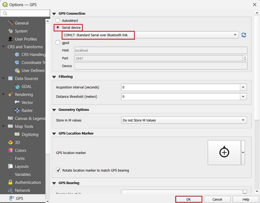
- Select Serial device and choose the Standard Serial over Bluetooth link COM port, press OK.
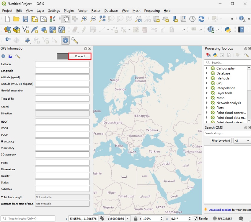
- Go back to the main screen. Press Connect.
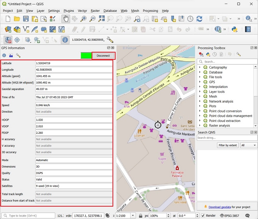
- You will see GPS Information on the panel. You can now track the position with your preferred map Plugins or layers imported from other applications.
Connect to NTRIP correction service
There is no built in NTRIP functionality in QGIS, but there are still options to connect to your preferred NTRIP or u-blox PointPerfect correction service.
Because we use 2 different applications, QGIS and u-center (providing NTRIP corrections), working on the same serial connection we need to create a virtual serial COM port. This new port will allow multiple connections at the same time over it.
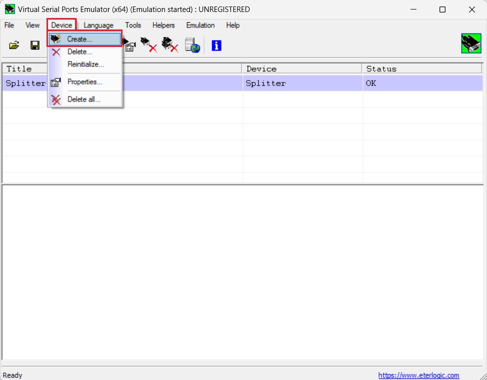
- Open Virtual Serial Ports Emulator and go to Device > Create.
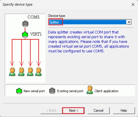
- At Device type choose Splitter and press Next.
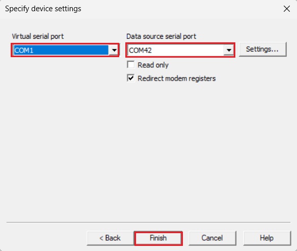
- At Data source serial port choose the COM port of your receiver, and at Virtual serial port choose a number that is not in use. Press Finish.
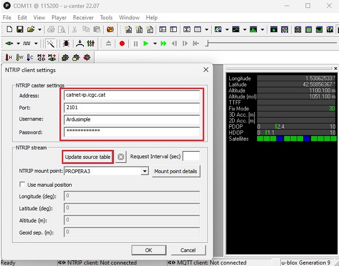
- Open u-center and connect your receiver via the new Virtual Serial port. Connect to your preferred NTRIP or PointPerfect correction services by following the tutorials:
- Go back to QGIS and connect again to your receiver but using the Virtual Serial port this time. You should find that the position is now at centimeter-level accuracy and Float/Fix RTK Quality.
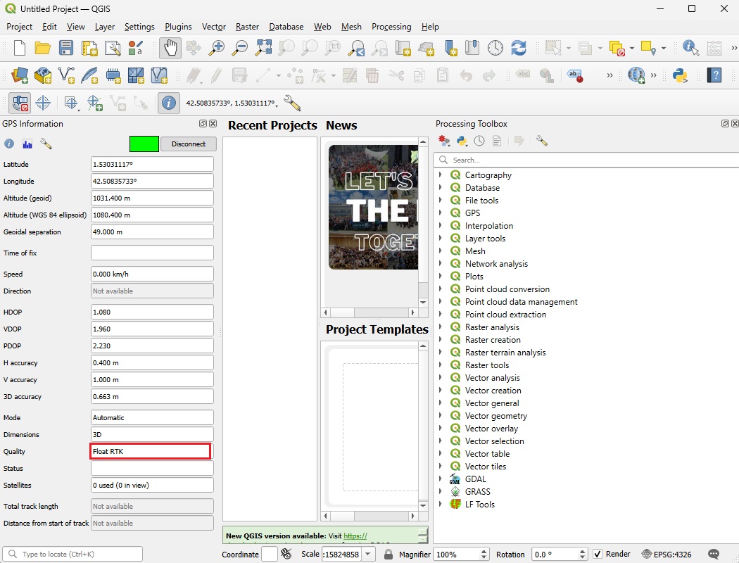
An easy way to power the RTK Portable 2 kit and, at the same time, provide corrections to the receiver to improve position up to centimeter-level accuracy is to connect it to an Android smartphone or tablet. Then you can use Android Mock location feature and ArduSimple GNSS Master app to connect to a correction service.
- Follow the tutorial on How to use centimeter GPS with any Android app (mock location). If you used USB connection for QGIS in the computer then use Bluetooth connection for GNSS Master app in the Android device, and vice versa.
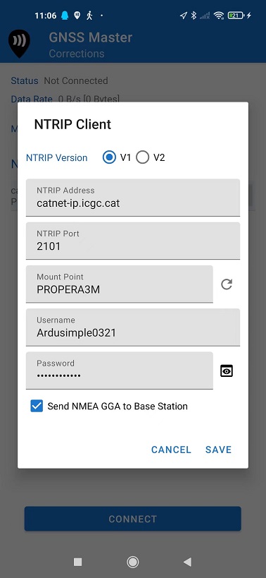
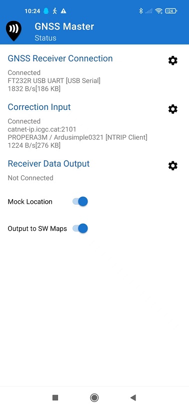
- Once corrections are sourced in GNSS Master app you can go back to QGIS. You should find that the position is now at centimeter-level accuracy and Float/Fix RTK Quality.
Related products

RTK Smart Antenna
Use your smartphone to perform surveying and geodesy jobs with this all-in-one NGS certified RTK receiver. You can finally buy instead of rent. If you need tilt compensation, click here.
RTK Handheld 2 Mapping Kit
Use your smartphone to create centimeter accurate maps. Capture precisely geotagged data. Perform surveying jobs.
RTK Portable 2
Universal and compact RTK receiver for your centimeter tracking tasks. Fits any type of project, just add your preferred GPS antenna.
Still having issues?
Contact us for support from a real engineer—not AI—or request the tutorial you’re missing