 and
and 
RTK correction services and NTRIP Casters in Iceland
Table of Contents
✈︎ ArduSimple delivers to customers in Iceland in 1-3 business days!
If you’re in Iceland and need centimeter-level position accuracy, you’ll need access to an RTK correction service or NTRIP Caster via the internet. Below are the main options available, explained in a simple way so you can quickly choose what fits your project.
In order to access real-time services and obtain NTRIP credentials, you need to register on the website or send them an email. The registration process is not always very user-friendly, so it might take some effort. If you run into any difficulties, contact us – we’re happy to assist.
National RTK network in Iceland
Iceland has established own national RTK Network to support various high-precision GNSS applications within the borders. This is the recommended option, especially if your work needs to match official maps or legal coordinates.
| Service | Type | Access | Accuracy | Coordinate System |
|---|---|---|---|---|
| IceCORS | Free national service | View coverage map and register | High-quality service with absolute accuracy ✔ Recommended for any type of work in Iceland | Regional ISN2016 |
In Iceland, cadastral and official data are based on the ISN93 coordinate system. This means that if you want to compare cadastral data with the position reported by the RTK receiver, coordinate transformations may be required.
Google Maps uses a global Coordinate system (WGS) to calibrate maps. To take measurements and compare them with Google Maps, it is easier to use a RTK correction service using a global coordinate system (you will find them further down).
Free international RTK correction services in Iceland
These free services are a good starting point, especially if you want to test or keep costs low. However, they come with some limitations, mainly in terms of reliability, accuracy, or coverage. You can use them to achieve centimeter-level accuracy in Iceland if you are lucky to have a base station close to you (remember that RTK only works up to 35-50 km).
| Service | Type | Access | Accuracy | Coordinate System |
|---|---|---|---|---|
| RTK2GO | Free global community-based network | RTK2GO coverage map ("View all" on the top right) + Register | Network without quality of the service ✔ Great if you only need pass-to-pass accuracy and you don't need to compare measurements taken by other systems or with local maps. Community-based RTK networks are the cheapest way to go, but are maintained by individuals, so quality depends on the area. ✖ Not suitable for surveying calibrated applications. | Not standardized |
| IGS | Free global service | IGS coverage map + Register | High quality service with absolute accuracy but low density of base stations. ✔ It is more reliable than community networks. You can use it to achieve centimeter-level accuracy if you are lucky to have a base station close to you. ✖ Limited coverage and low base station density. Check the coverage map to see if you have a base station nearby (remember that RTK only works up to 35-50 km). | Global ITRF |
| Earthscope (previosly UNAVCO) | Free (for non-commercial use only) global service | Earthscope coverage map register | Typically ITRF, but bases are in reginal frames |
This tutorial walks you through How to connect to the NTRIP correction service (like RTK2GO) via PC.
Set up your own correction service
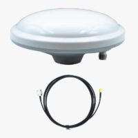
If you didn't find anything nearby you or you simply would like to become independent from any service, check out our ready-to-use all-band, full-constellation RTK Base Station. Setup is simple—just follow the User Guide: RTK Base station.

Galileo HAS: a free option but lower accuracy compared to RTK
If 40 cm accuracy is sufficient for your project, you can try Galileo HAS, a free, globally available correction service.
- It works without the internet, NTRIP, or a local base station. While not as precise as RTK, it can still improve positioning accuracy. However, it takes up to 5 minutes to reach full accuracy, compared to just a few seconds with NTRIP.
- Galileo HAS uses the GTRF reference frame, which is closely aligned with ITRF global coordinate system (differences are typically below 3 cm). This means you will usually have to do a conversion to local coordinate system to compare measurements with other maps.
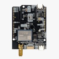
- Not all RTK boards are compatible with Galileo HAS. Here are GNSS RTK receivers that fully support Galileo HAS:
-
-

-
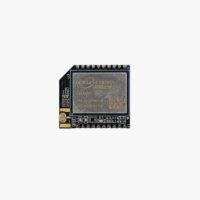 RTK3B Boards
simpleRTK3B Micro Unicore
From 276,00€ This product has multiple variants. The options may be chosen on the product page
Post-processing (PPK) instead of RTK
If you are looking for post-processing (PPK) instead of RTK in Iceland, contact us — we’ll help you find the most appropriate service for your project.