and
and 
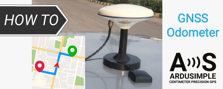
How to use the odometer functionality of u-blox to measure distance
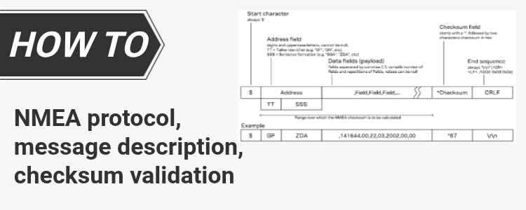
Table of contents The GNSS odometer is a useful built-in feature available on u-blox RTK receivers. It continuously calculates the distance travelled by the receiver using GNSS position and velocity information, allowing you to measure the length of a route without any additional sensors. The odometer functionality is configured through the UBX-CFG-ODO message and the […]
How to use the odometer functionality of u-blox to measure distance Read More »