On this page
No headings were found on this page.
Products used in this tutorial
If you’re a land surveyor, construction professional, or engineer using SurPad for your surveying and mapping projects, this guide will walk you through the step-by-step process of connecting your ArduSimple RTK kit for easy integration and centimeter-level accuracy.
SurPad supports external GPS/GNSS receivers and has a built-in NTRIP client, allowing you to receive real-time RTK corrections over the internet. By pairing your ArduSimple RTK kit with SurPad, you can achieve centimeter-level accuracy in your fieldwork.
Before starting this tutorial, make sure you have the necessary credentials to connect to an NTRIP service. If you’re unsure about NTRIP services in your area, we’ve prepared a list of services specific to your country
SurPad supports external GPS/GNSS receivers and has a built-in NTRIP client, allowing you to receive real-time RTK corrections over the internet. By pairing your ArduSimple RTK kit with SurPad, you can achieve centimeter-level accuracy in your fieldwork.
Before starting this tutorial, make sure you have the necessary credentials to connect to an NTRIP service. If you’re unsure about NTRIP services in your area, we’ve prepared a list of services specific to your country
Required hardware:
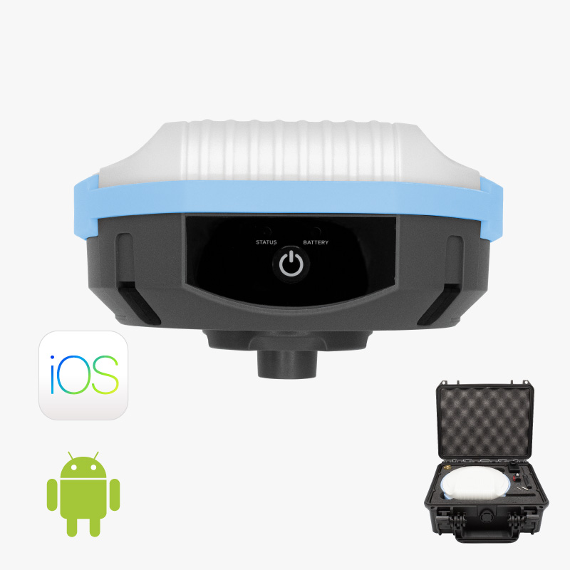
- RTK Calibrated Surveyor Kit
- an Android smartphone or tablet
Required software:
- SurPad
How to use ArduSimple external RTK GNSS receiver with SurPad for centimeter-level accurate survey work?
Firstly, connect ArduSimple kit to SurPad.
- Connect the antenna to your receiver and power your receiver with your phone or a power bank. Place the antenna in completely open air for testing the functionality.
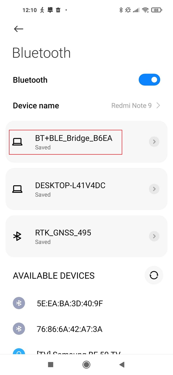
- Open Bluetooth settings on your Android device, search for your RTK kit which name will be BT+BLE_Bridge_XXXX. Tap Pair. Note: This only need to be done once.
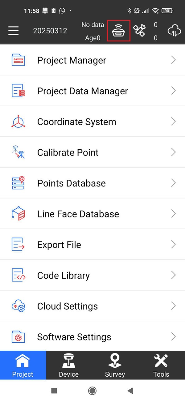
- Open Surpad. Tap the antenna icon on top menu.
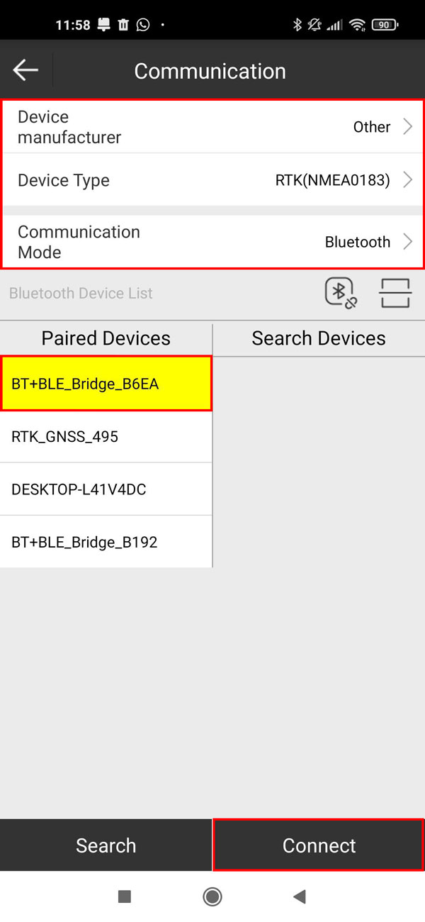
- At Device manufacturer choose Other, Device Type choose RTK(NMEA0183), Communication Mode choose Bluetooth.
At Paired Devices select the device you paired in step 2. Tap Connect.
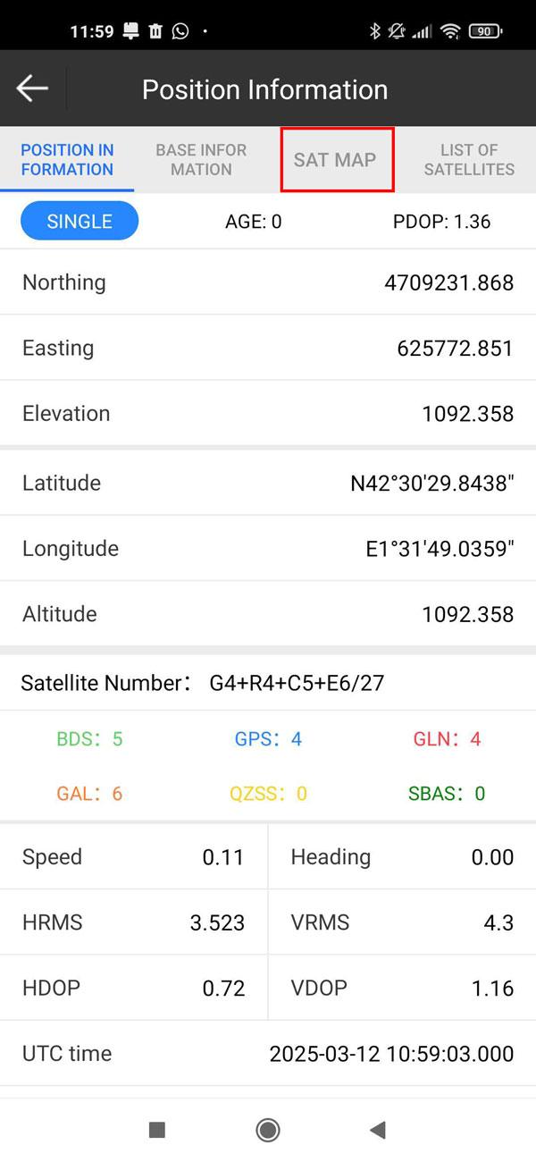
- Tap the satellite icon on top menu, you can see the location information.
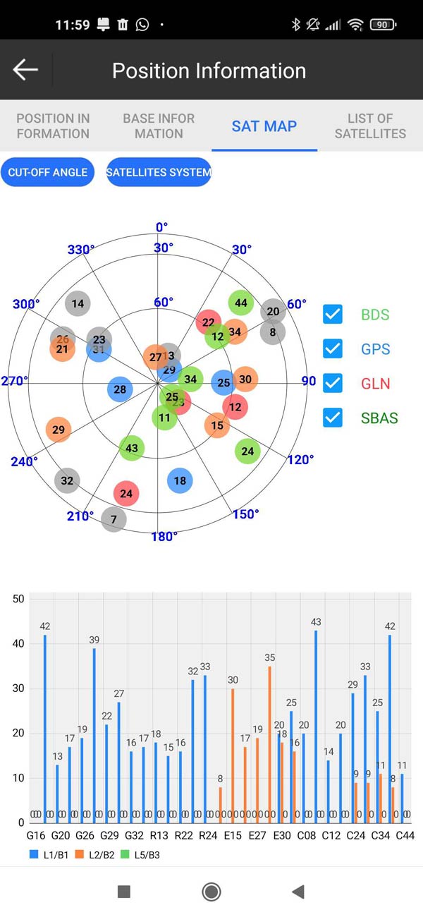
- Tap SAT MAP, you can monitor the satellite signal.
Secondly, connect to NTRIP correction.
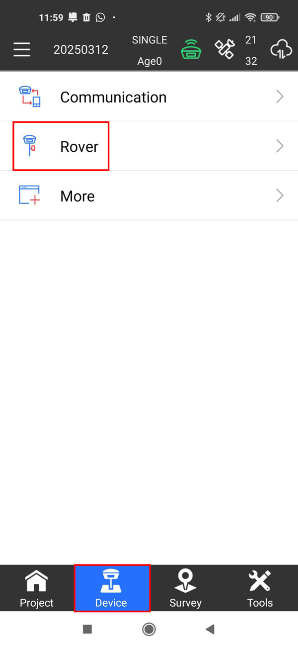
- Go to Device, tap Rover.
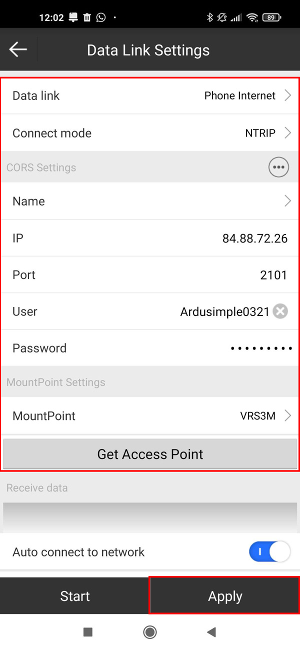
- At Data link choose Phone Internet. At Connect mode choose NTRIP.
Fill in the NTRIP credentials (IP, Port, Mount point, Username and Password). Tap APPLY.
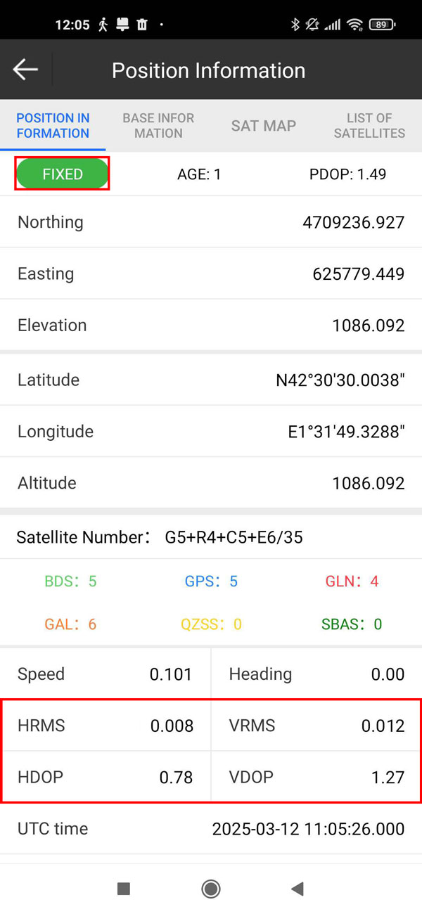
- Go back to Position Information, you will see fix type change to FLOAT or FIXED.
HRMS is the Horizontal Root Mean Square. VRMS is the Vertical Root Mean Square. With a high-quality RTK FIXED solution, accuracy will reach centimeter level. Additionally, HDOP (Horizontal Dilution of Precision) should remain below 1 for optimal performance.
Now you can use SurPad for your filed work with centimeter-level accuracy.
Related products
RTK Smart Antenna
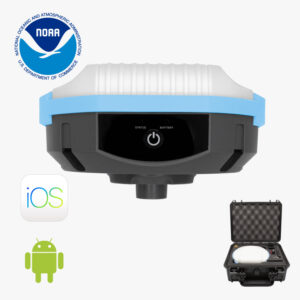
Use your smartphone to perform surveying and geodesy jobs with this all-in-one NGS certified RTK receiver. You can finally buy instead of rent. If you need tilt compensation, click here.
Still having issues?
Contact us for support from a real engineer—not AI—or request the tutorial you’re missing
and