How to use RTK Smart Antenna with WoodsApp for forestry mapping in Europe
Table of contents
Your forest on your mobile: always up to date. WoodsApp offers forest owners (currently in Germany, Austria, Spain, Portugal and Italy) a clear digital overview of their forest, no matter where they are.
Access your parcel map, monitor the health of your forest, mark important features, track activities, manage notes and tasks, deepen your understanding of your property and record observations directly on your mobile map. WoodsApp was developed together with forest owners, for forest owners.
In this tutorial, we show how to use the RTK Smart Antenna with WoodsApp, but you can also do it with RTK Handheld 2 Mapping Kit if you are looking for a lightweight device.
The RTK Smart Antenna is compatible with both Android and iOS devices, and WoodsApp is available for both platforms. However, WoodsApp does not include a built-in NTRIP client. For this reason, this tutorial focuses on Android only, because Android allows the use of mock location apps to send high-accuracy GNSS positions to other applications.
GNSS Master (required to use Android mock location)
How to use RTK Smart Antenna with WoodsApp for forest mapping
Enable Mock Location in your Android Device.
This step only needs to be done once.
Turn on your RTK device and wait for the LED indicators to confirm it is powered and searching for satellites. Place it outdoors in a place with a good sky view, for testing purposes you could place it near to a window.
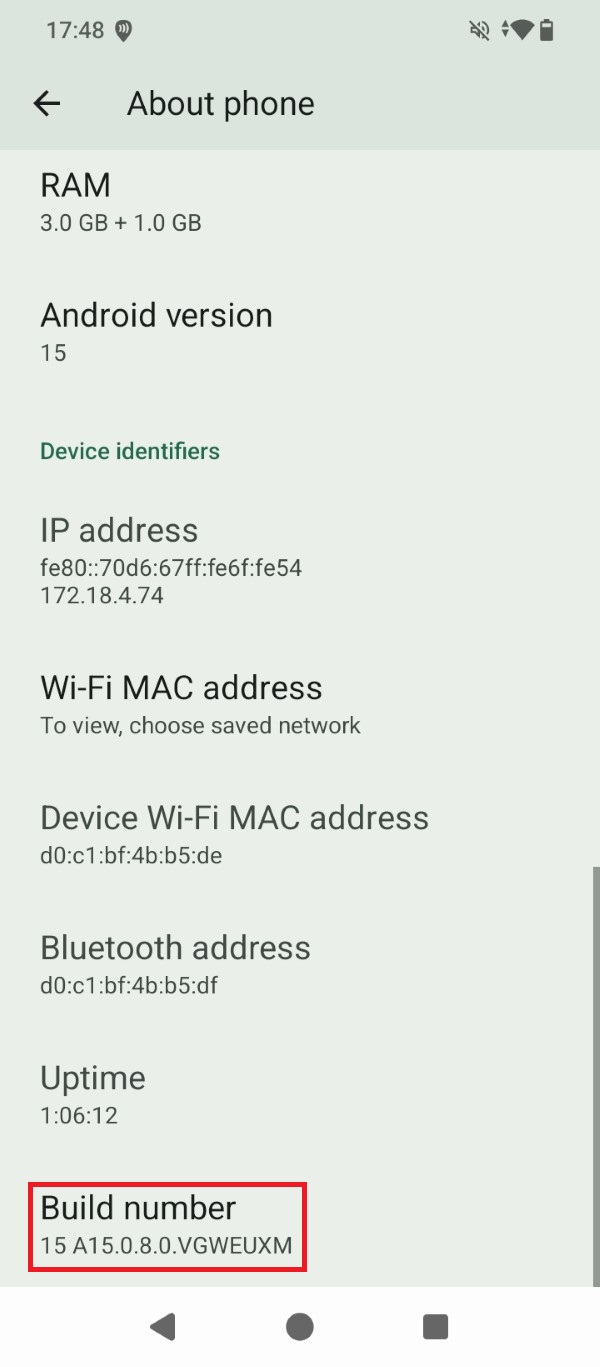
Activate Developer options in your Android device. Go to Settings > About phone and tap the Build number 7 times in a row.
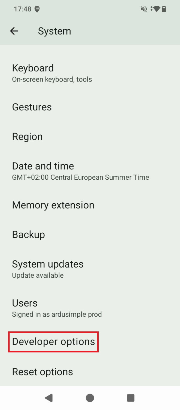
Tap the Developer options that now show under Settings > System.
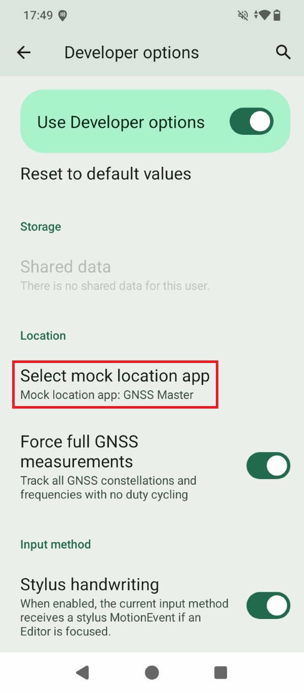
Go to Select mock location app and set GNSS Master as the mock location app for your Android device.
Connect the RTK receiver to your Android device
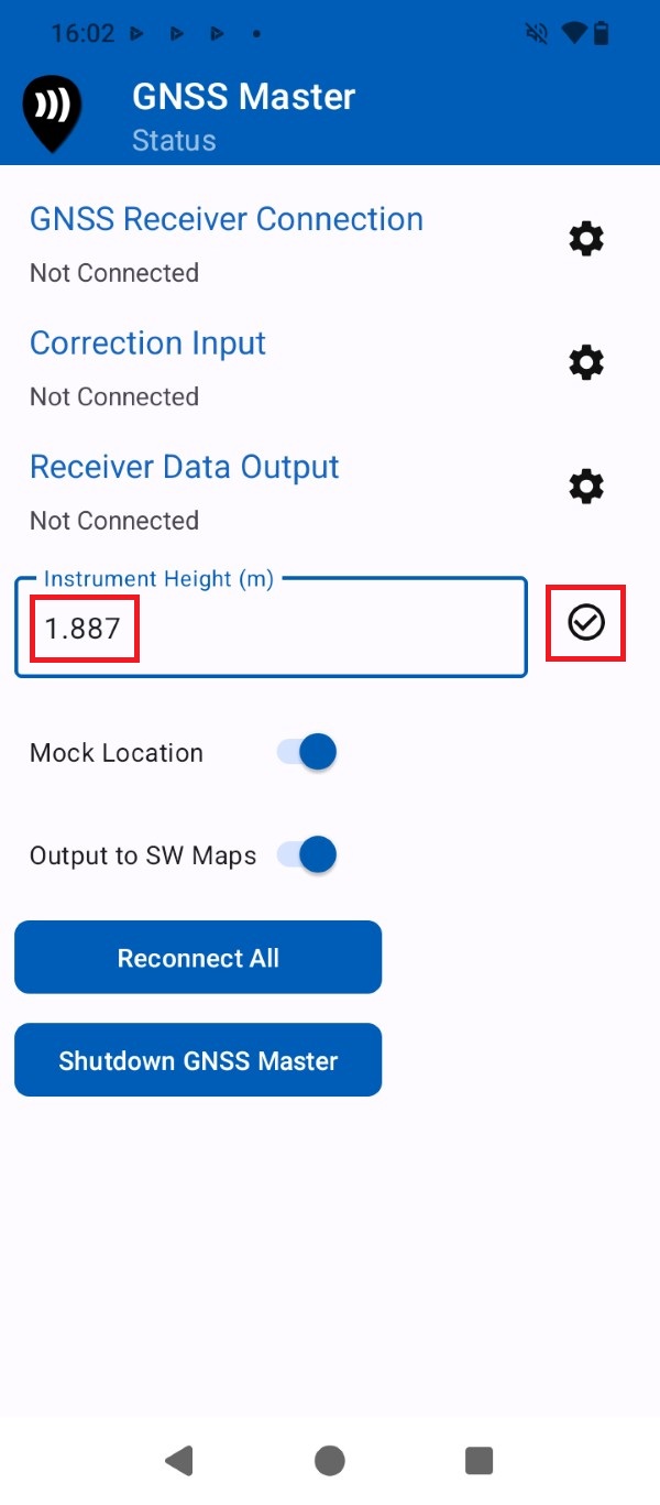
Open the GNSS Master app and input the Instrument Height (pole height + Antenna Phase Center) value in meters. You can find the Antenna Phase Center at your ArduSimple RTK Kit User Guide.
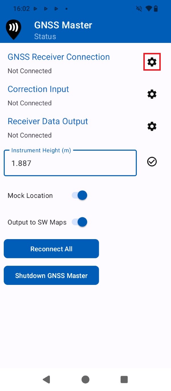
Press the gear icon for GNSS Receiver Connection.
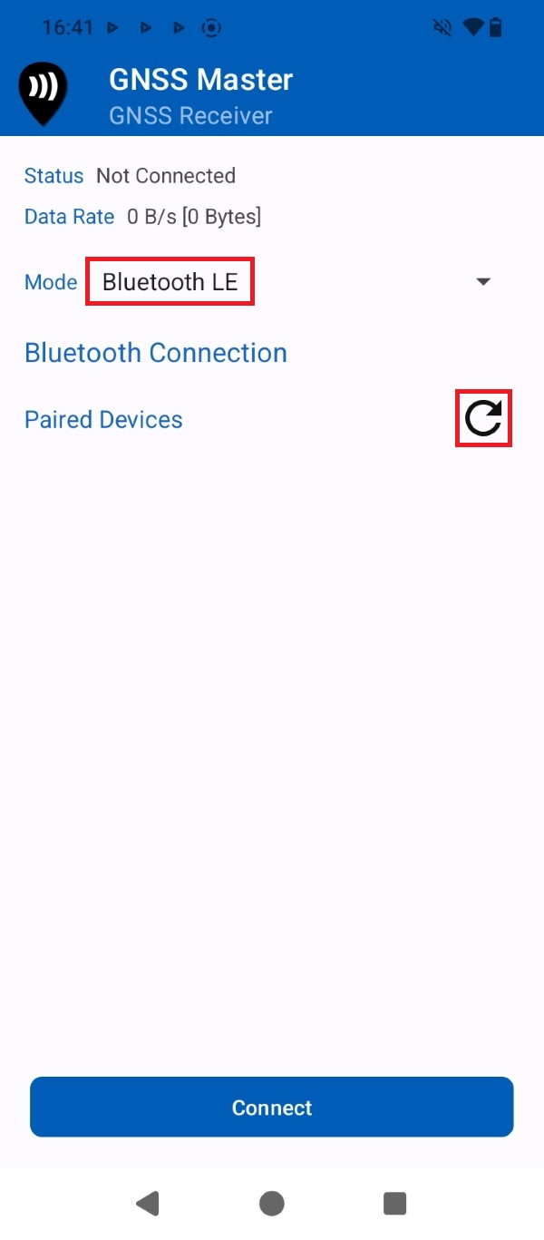
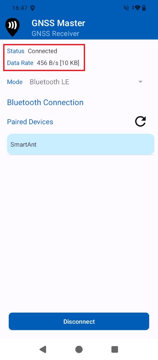
At Mode expand the drop-down menu and select Bluetooth LE. Press the Refresh icon.
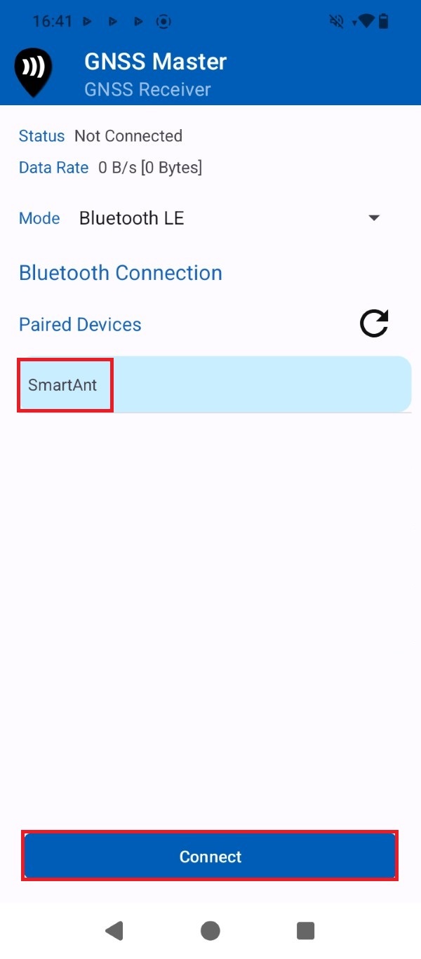
Select your ArduSimple RTK Kit device name from the list and press Connect.
Check that the Status is set to Connected. After a few seconds the GNSS receiver should find enough satellite signals and start sending data.
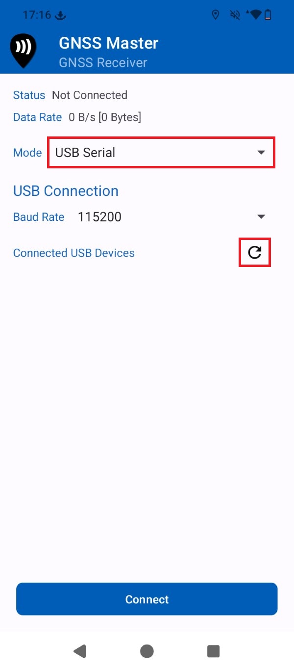
At Mode expand the drop-down menu and select USB Serial. Press the Refresh icon.
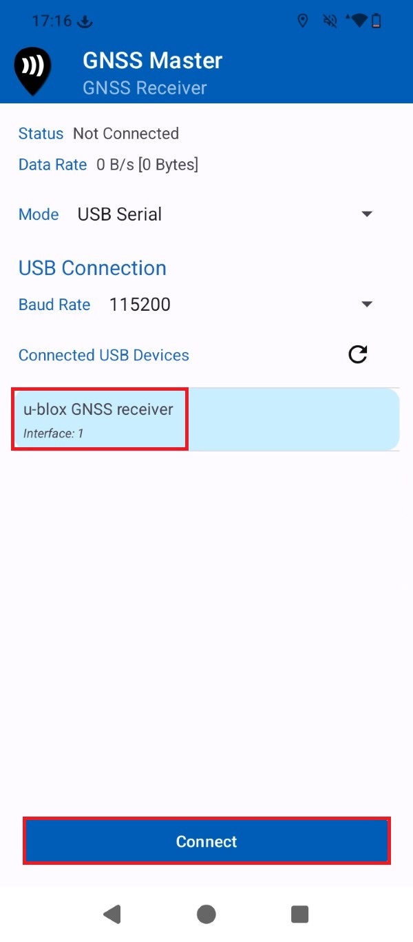
Select the GNSS receiver device from the list and press Connect.
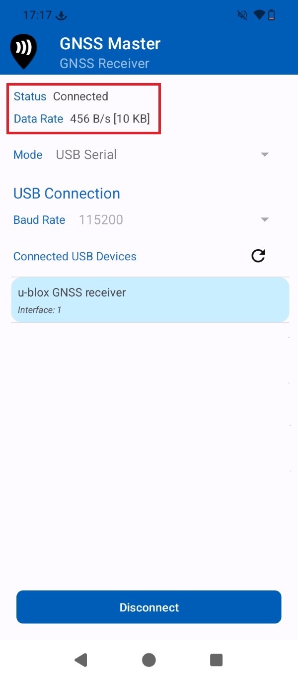
Check that the Status is set to Connected. After a few seconds the GNSS receiver should find enough satellite signals and start sending data.
Get RTK corrections
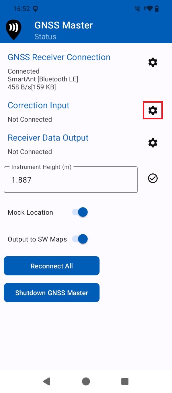
To achieve centimeter-level accuracy, you must connect to an NTRIP service to receive RTK corrections. If you need assistance finding one, consult our prepared list of RTK correction services in your country. GNSS Master app does include a built-in NTRIP client so you can achieve centimeter-level accuracy in your Android smartphone or tablet for free. Go back to GNSS Master Status and press the gear icon for Correction Input.
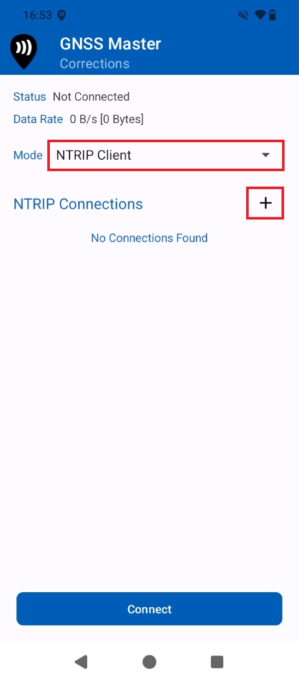
Open the Mode drop-down menu and select NTRIP Client. Press the + icon.
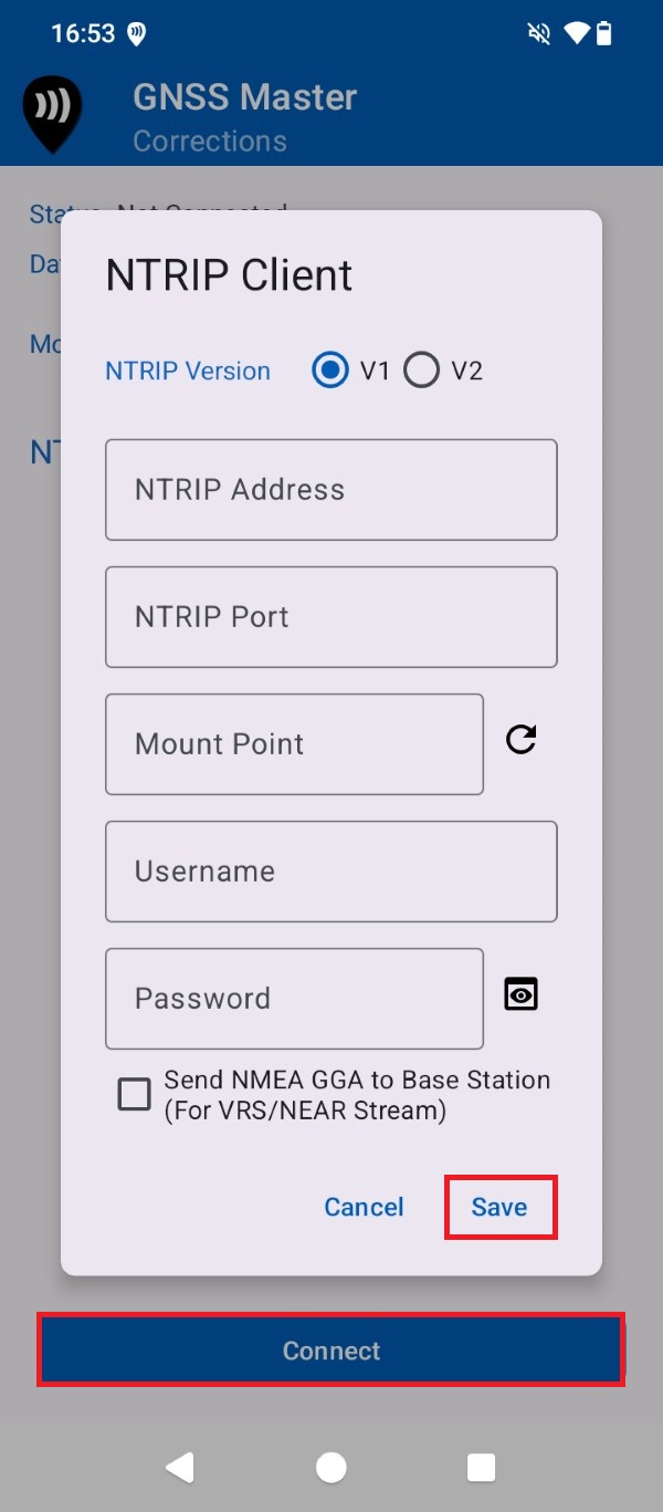
Input your NTRIP correction service credentials. Press Save and Connect.
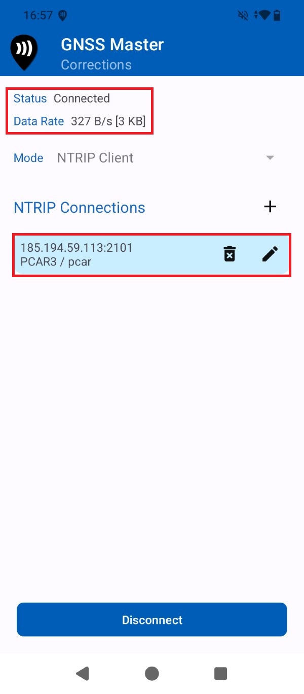
A successful connection will show with a data bitrate.
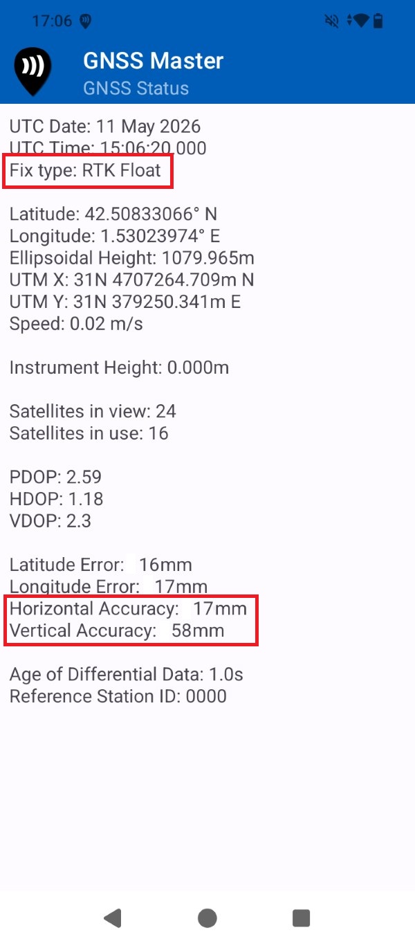
Go to GNSS Master app main menu > GNSS Status. After a few seconds the receiver Fix Type should be RTK Float/Fix and the output data be at centimeter-level accuracy.
Create a WoodsApp free account
Before start using the WoodsApp app you will have to create an account. If you do not have an account already we recommend starting with a free account, which you can always transfer to a paid one afterwards. This only needs to be done once.
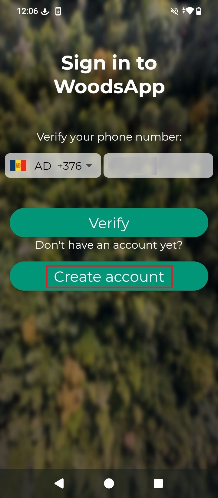
Open WoodsApp and at the Sign in screen press Create account.
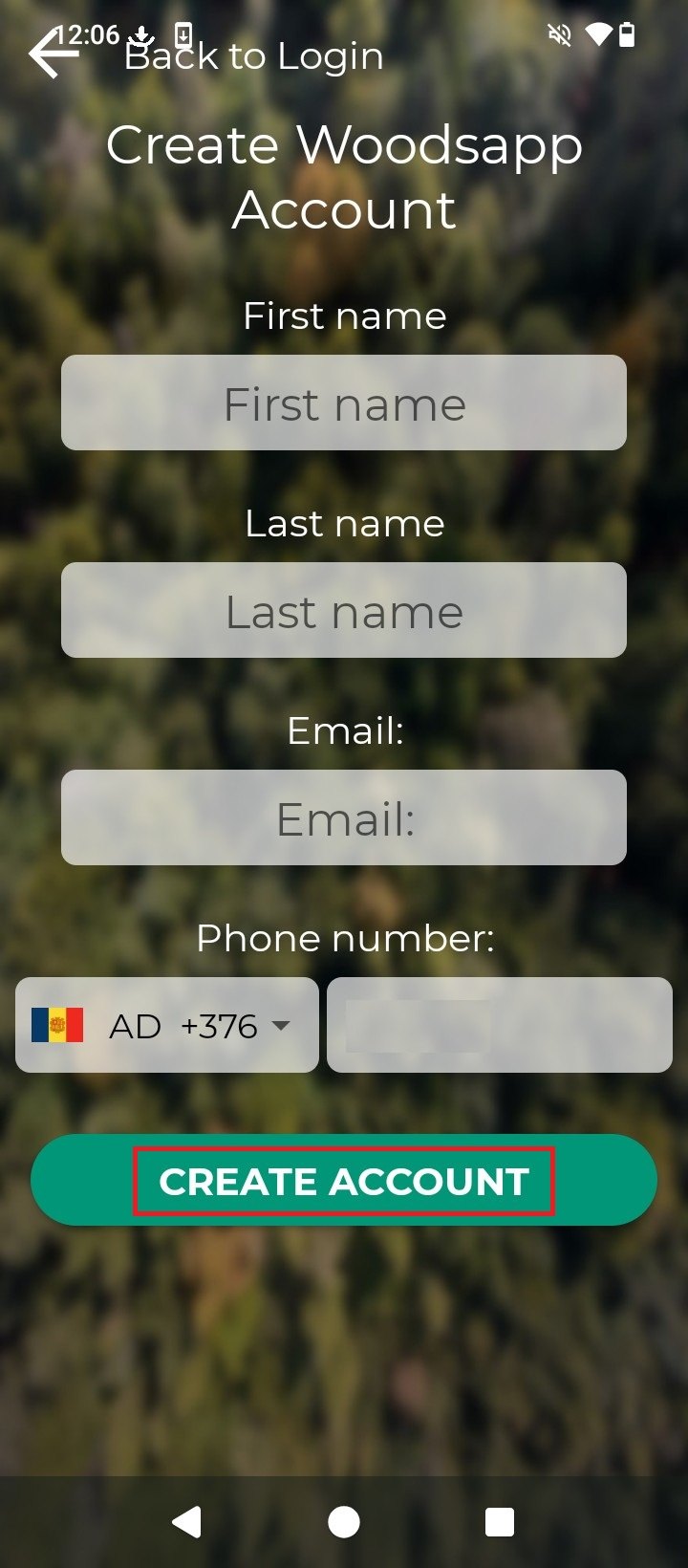
Fill the form with your personal information, press Create Account.
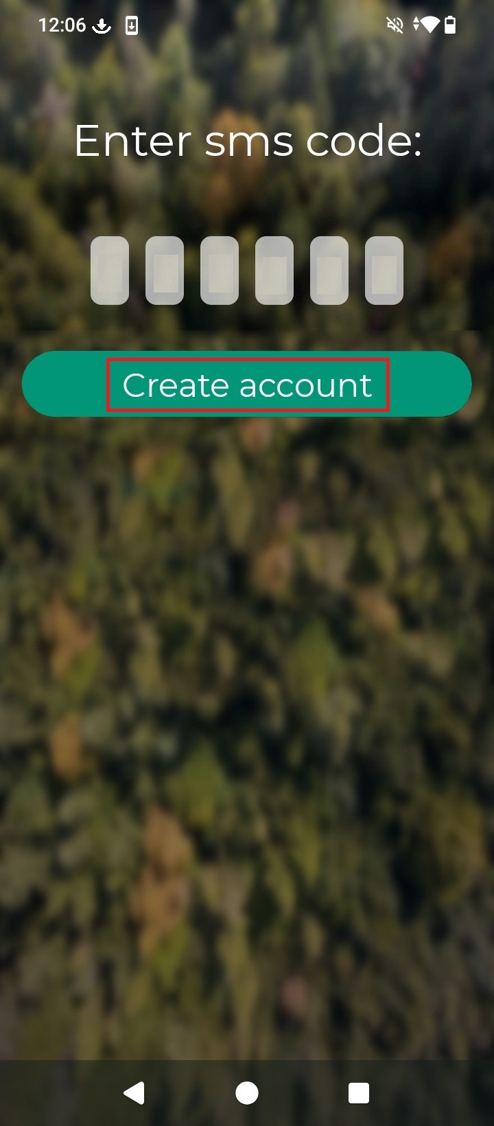
You will receive a SMS in your smartphone with a code to activate your WoodsApp account. Input the code and press Create account.
Map with WoodsApp and centimeter-level GPS positioning accuracy
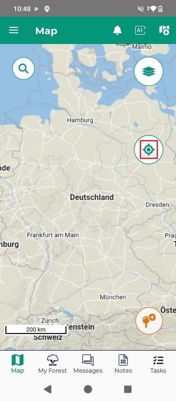
Once inside the app you will be presented with the default map view. To focus into your location press the center map icon.
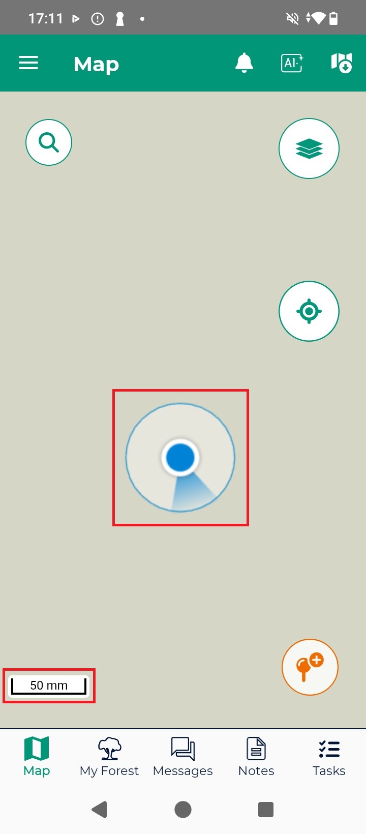
Because we have previously activated mock location using the GNSS Master app, the location shown is already at centimeter-level accuracy. You can check the accuracy level by zooming in your location until you find a blue circle around it… the radius of the circle corresponds with the accuracy level (around 4 cm in the picture below).
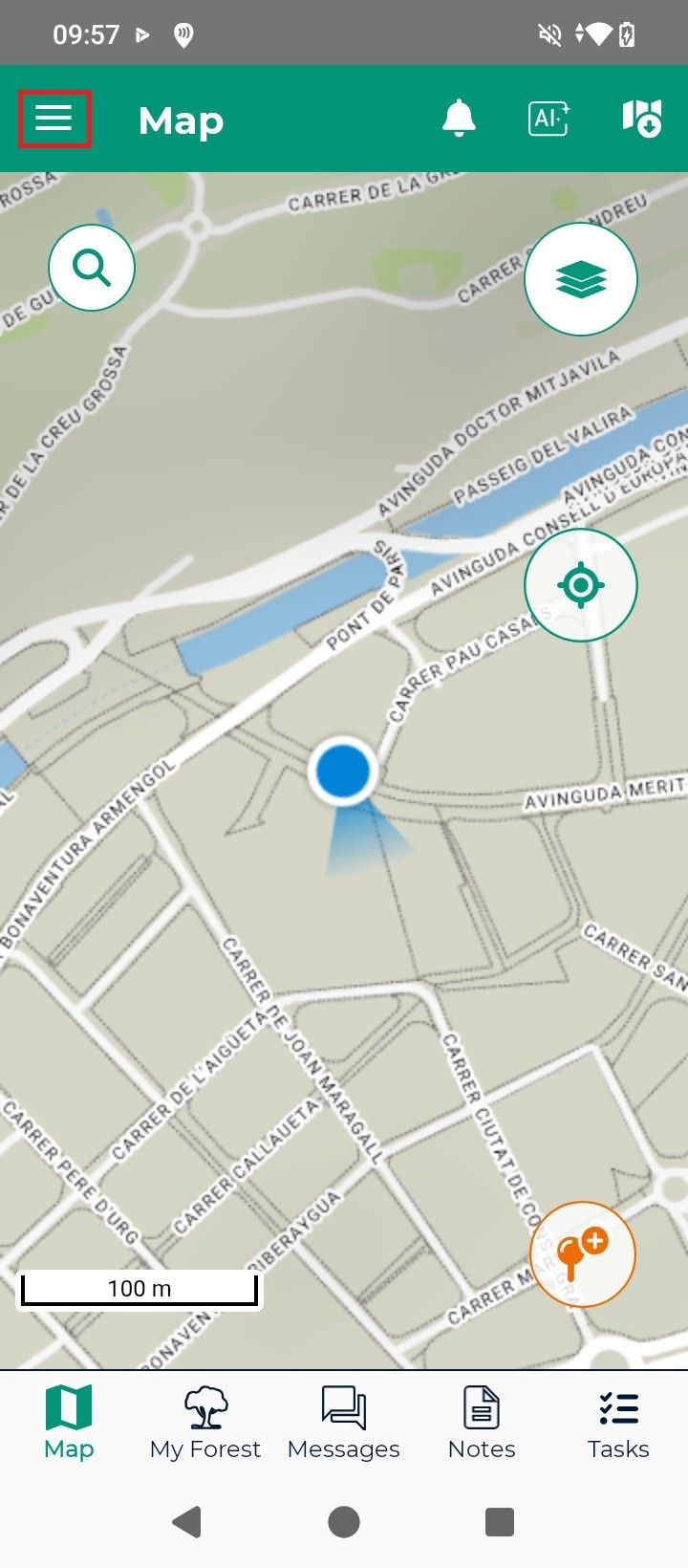
Press the WoodsApp main menu icon.
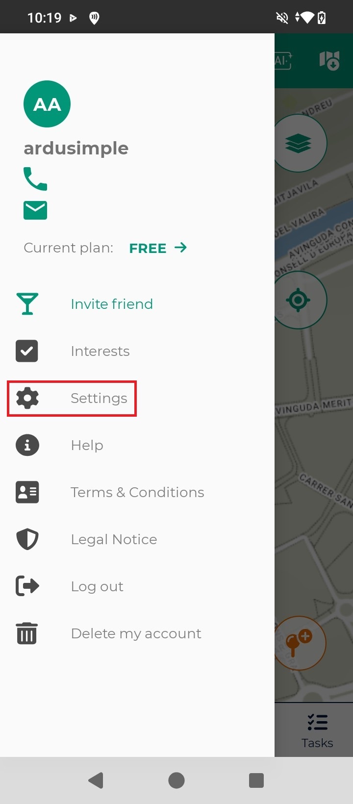
In the WoodsApp main menu, press Settings.
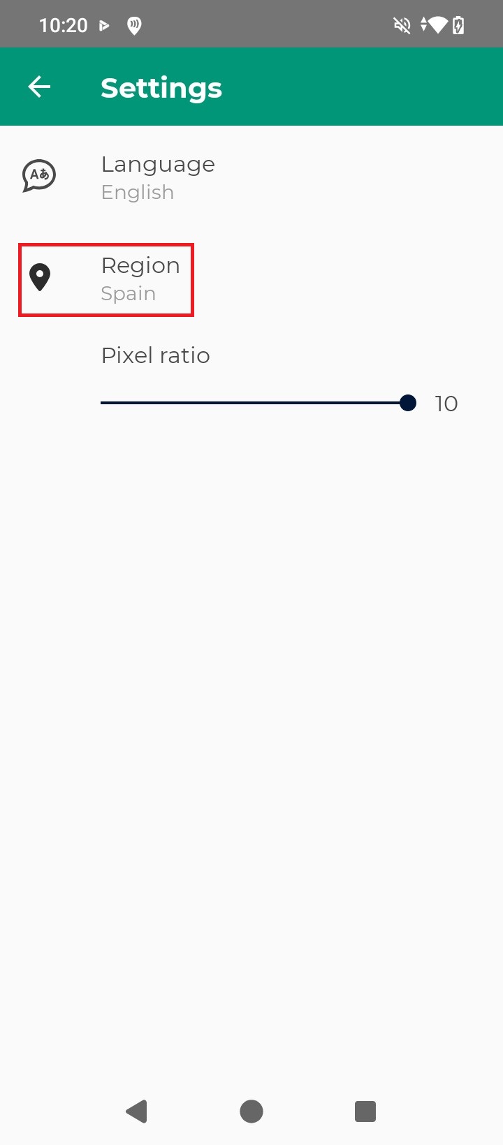
In the WoodsApp Settings menu, press Region.
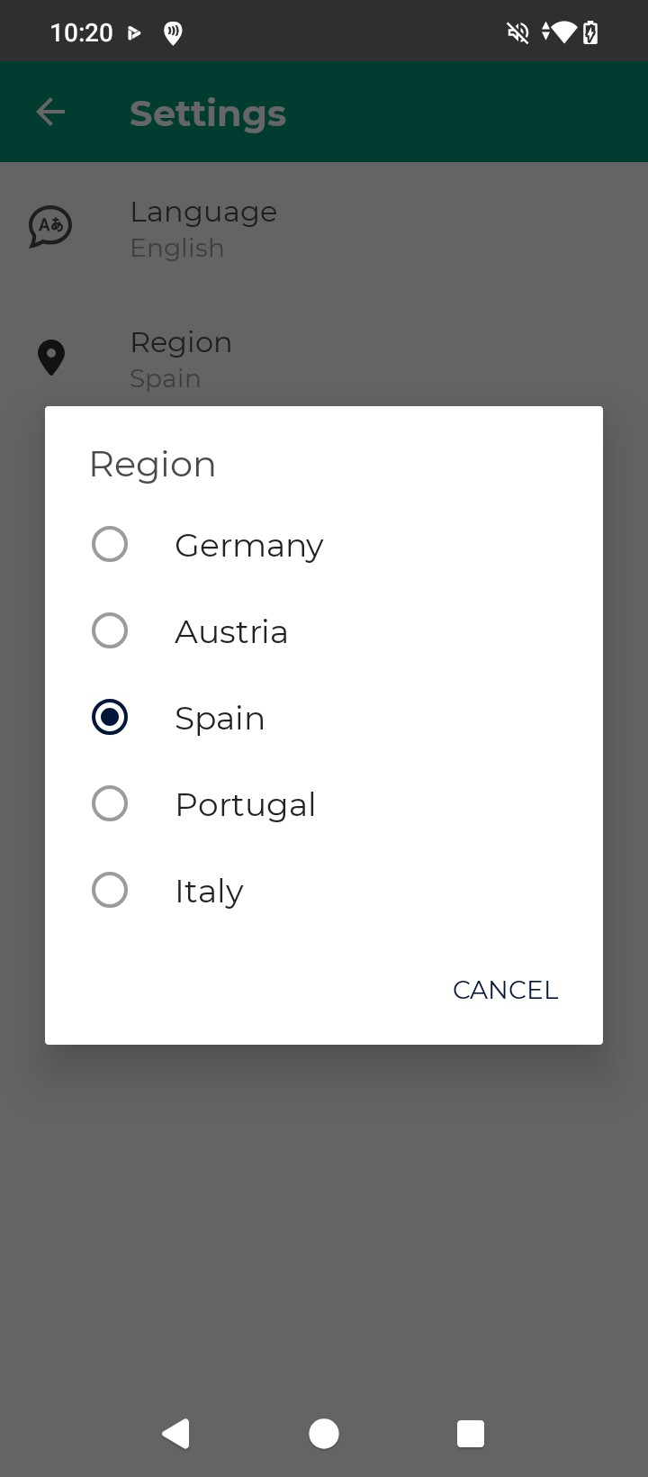
Select your Region.
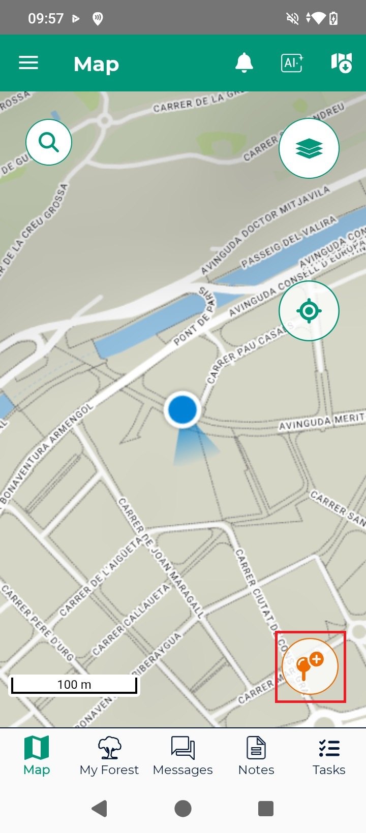
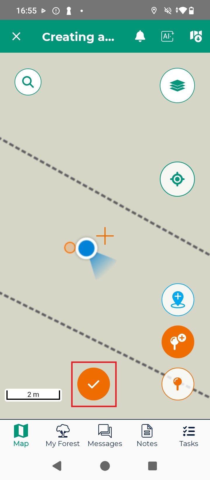
You can now start your forest management project with high precision thanks to RTK technology. For simplicity we will create just a note associated to a saved position, press the add position icon.
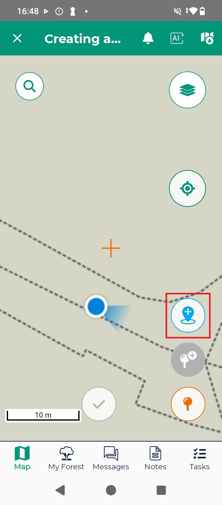
To create a saved position in the map press the add position blue icon.
Press the check mark icon.
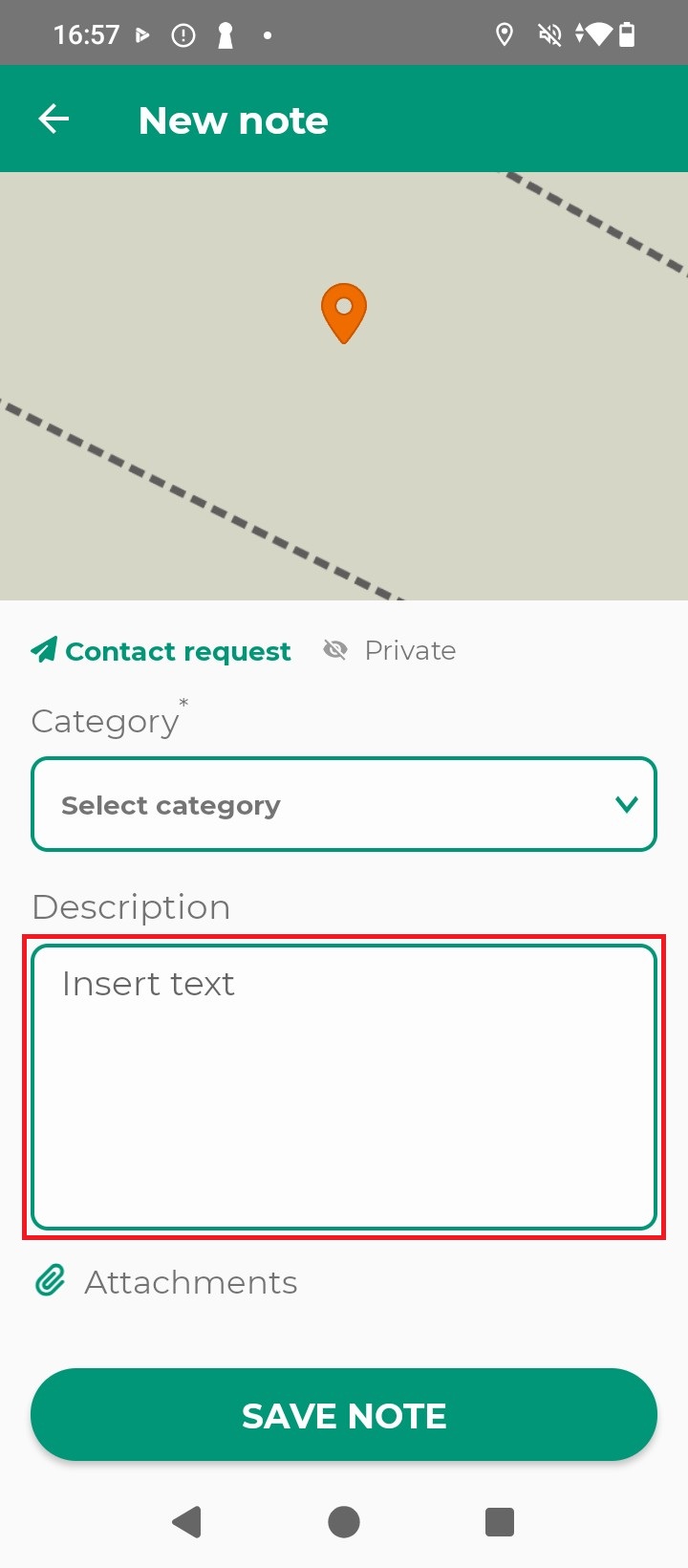
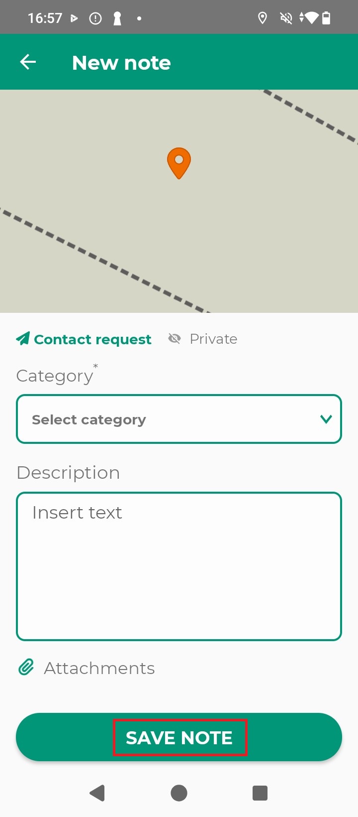
In the new note screen, input a Description text.
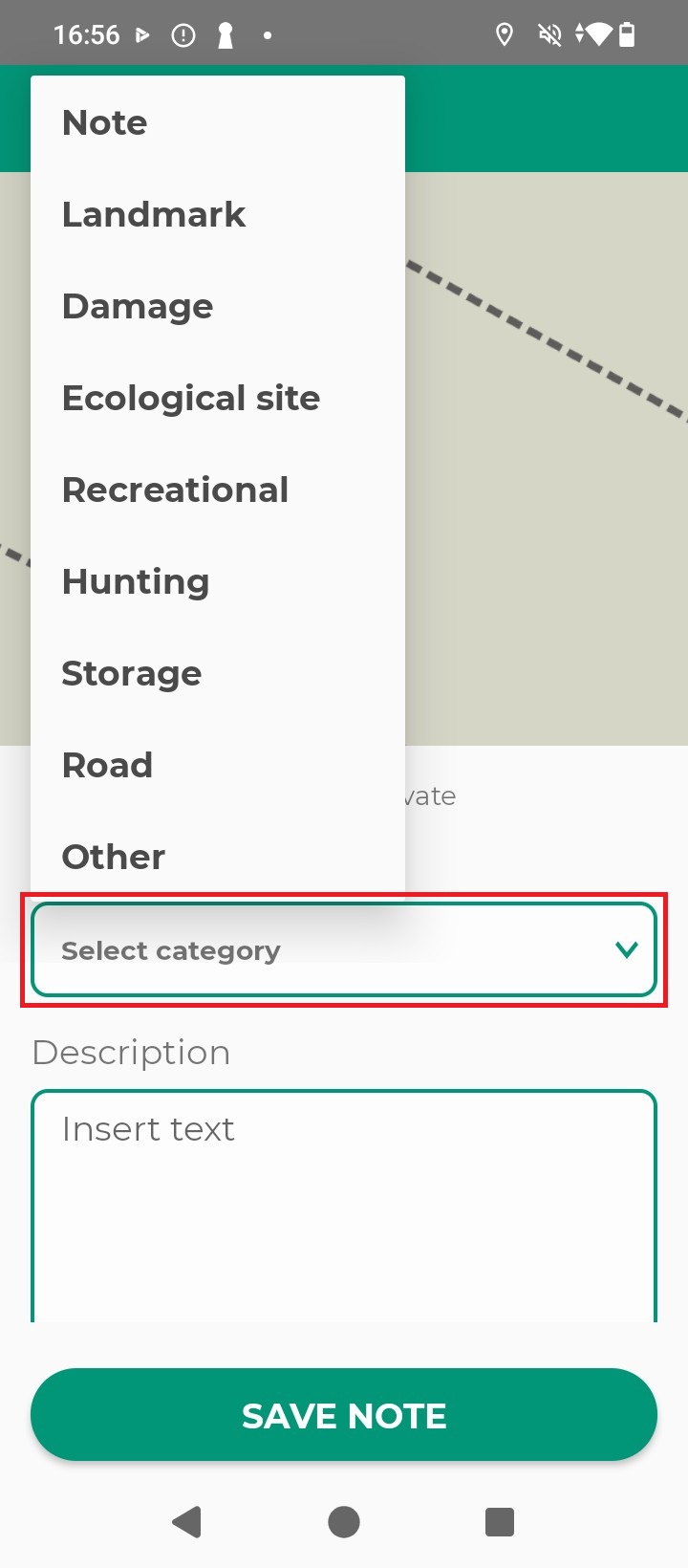
Select a note Category.
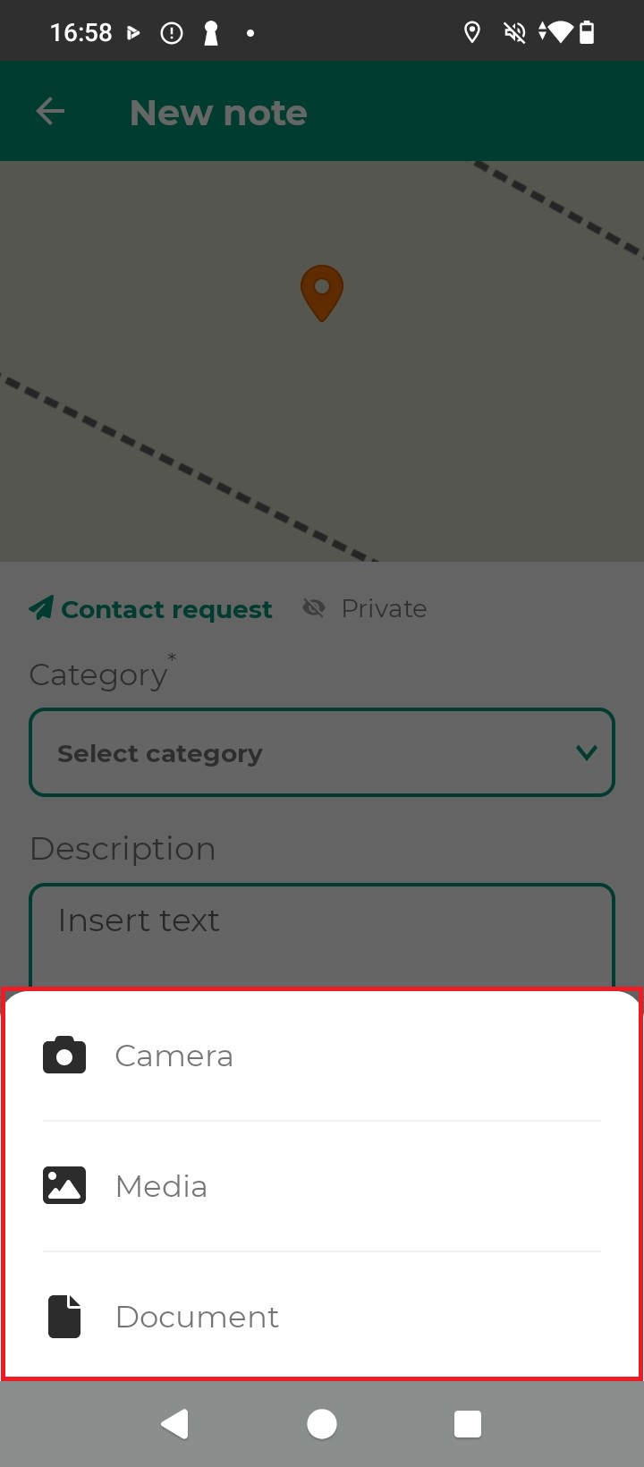
You can also, if needed, add a note Attachment.
Press Save Note.
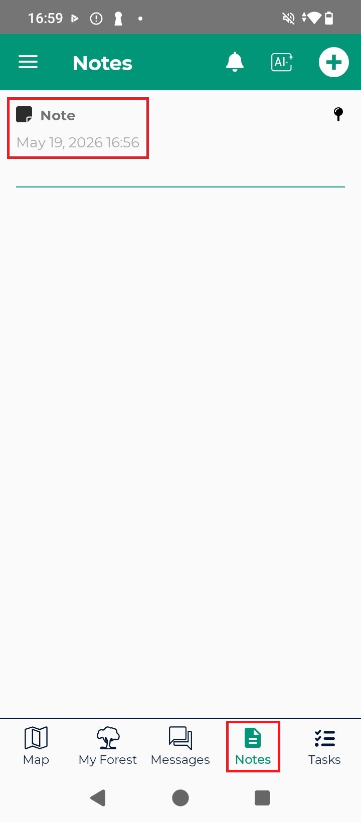
You will find your newly created note in the Notes section.

 and
and  How to get a quotation