How to solve boundary disputes with your neighbor using RTK kit
If you and your neighbor aren’t sure where the property line really is, it can get tense fast. The good news is, you can clear things up yourself using our RTK kit and your property’s official cadastral map. That map holds the legally recognized coordinates for your land’s boundary points — the “truth” both of you can rely on. You simply get the map from your local land registry and load the coordinates into your smartphone. With the help of our kit, connected to the local correction service, you head outside to find those points in the real world. Walking with the kit, you’ll see exactly where the legal markers are supposed to be, right down to one centimeter. You can compare those precise points with your current fence, wall, or garden edge to see if they match. If they don’t, you’ll know exactly where the legal boundary runs, backed by cadastral data. With this information, you can talk to your neighbor with confidence. This way, you go from doubt to clear answers — and you’ll know exactly where you stand.
How to solve legal boundary issues using low-cost RTK kit
Get your cadastral data
To get cadastral coordinates of your field, contact the government agency which manages cadastral data in your country (e.g., land registry, cadastral or mapping office). Many of them has opened online cadastral map, where you can search by your parcel number or address to find your field in the cadastral register. You can download this data in different formats. Shapefile format is widely used and should be available on your geoportal. It stores geometric shapes (like points, lines, and polygons) for land parcel boundaries. It is not a single file — a Shapefile consists of at least three files: .SHP — geometry (shapes) .SHX — shape index .DBF — attribute table (like a spreadsheet) We are interested in .SHP files. In the video below we demonstrated how to download cadastral coordinates of your parcel in Baden-Württemberg, Germany. We will use flurstueck.shp (contains information about parcel of the land) and grenzpunkt.shp (contains information about boundary point) files.
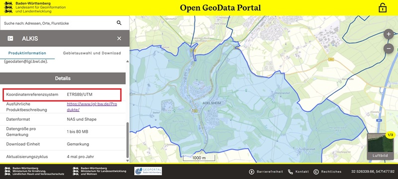
Once the files are downloaded, check which Coordinate system your cadastral agency uses. This is important because mismatched coordinate systems can lead to incorrect measurements. In our case it is ETRS89/UTM.
Prepare cadastral files for export
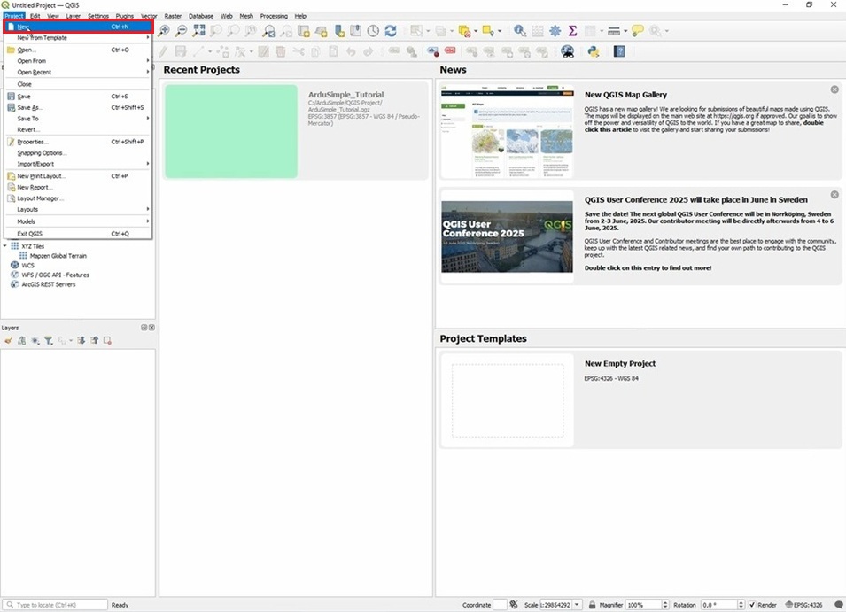
Open QGIS on your PC. To create a new project in QGIS, go to the menu Project and select New.
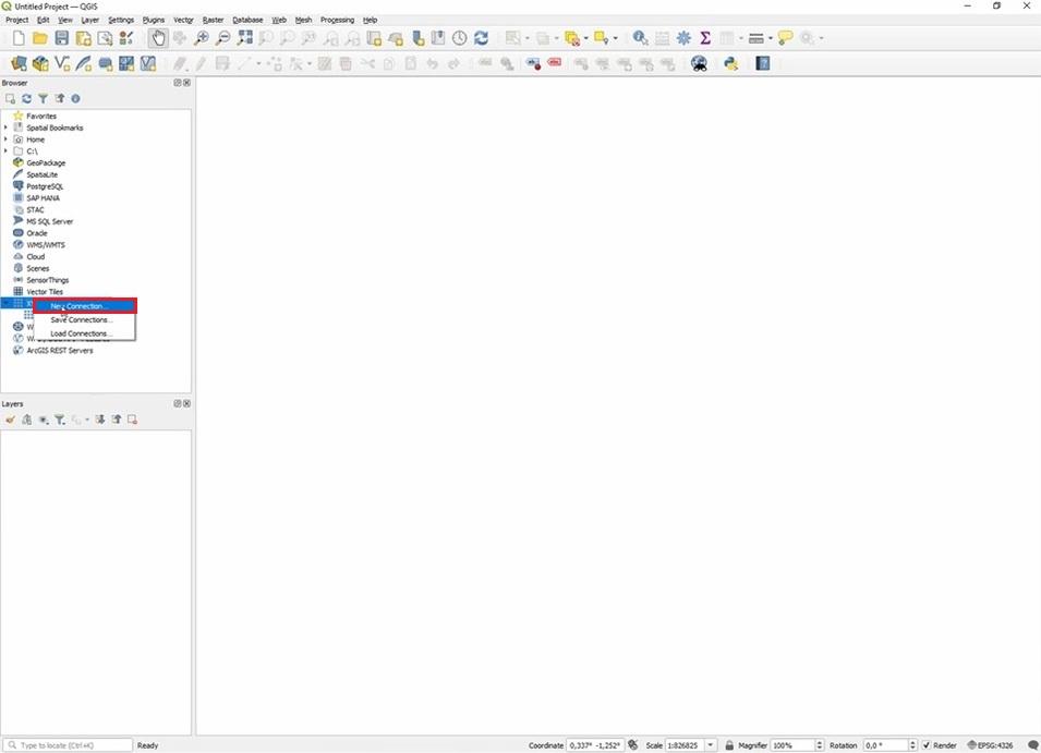
If this is the first time you are using QGIS, you need to create some more XYZ Tiles layers to be able to use Google Maps to find your land faster. To do this, in the Browser pane on the left side of the window, right-click on XYZ Tiles and select New Connection.
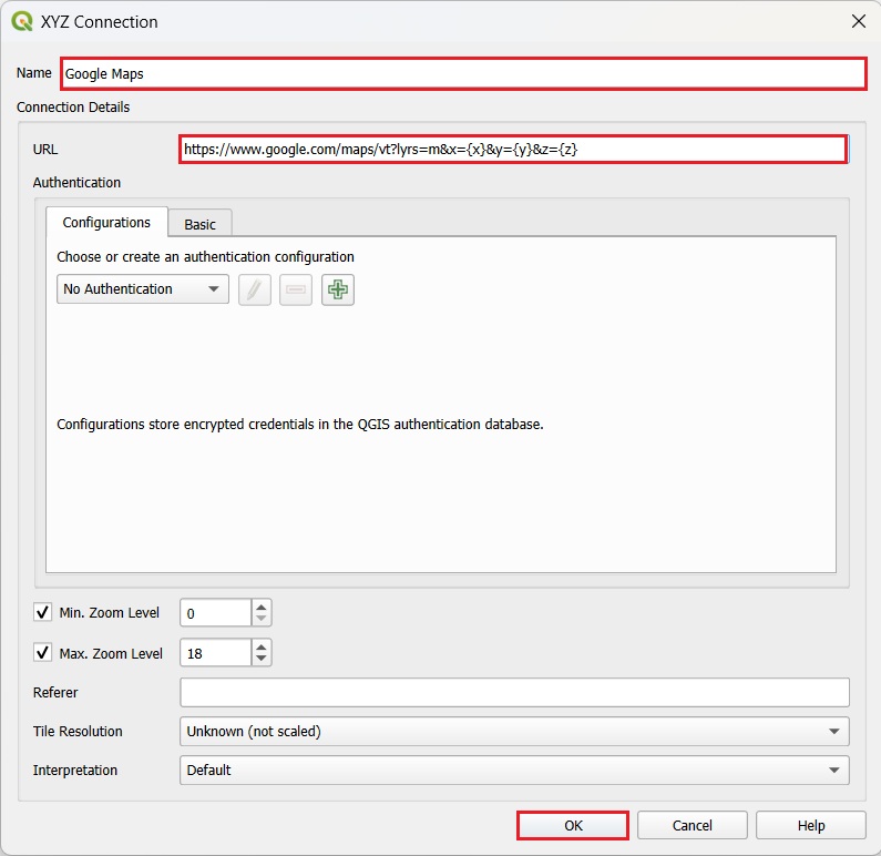
Fill in the Name and the URL and save the settings by clicking on OK. The required settings for Google Maps: https://www.google.com/maps/vt?lyrs=m&x={x}&y={y}&z={z}
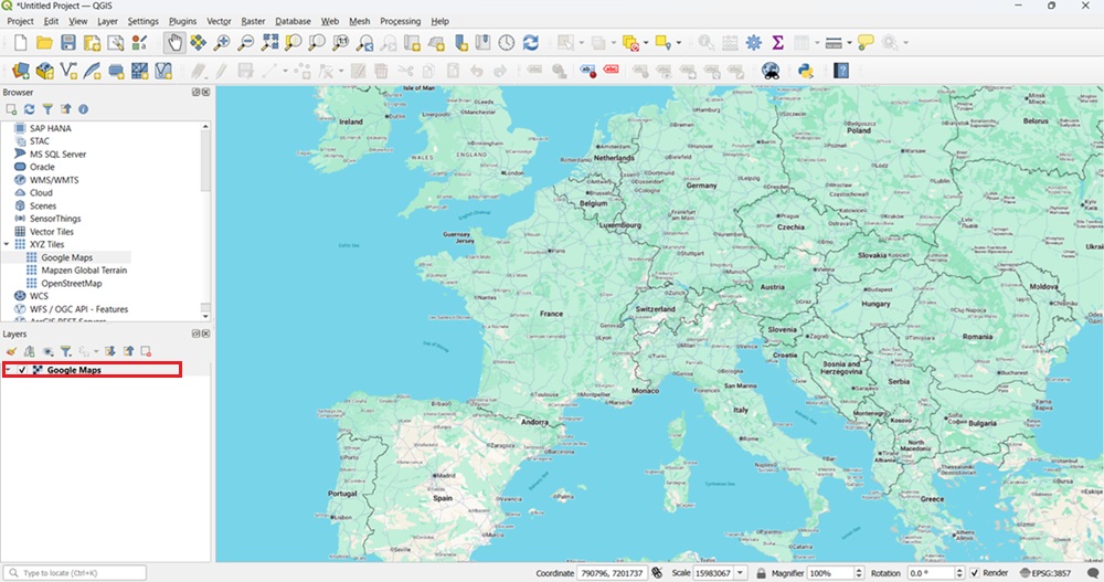
Add Google Map layer to the project by dragging a tile to the Layers pane on the bottom left side of the QGIS window.
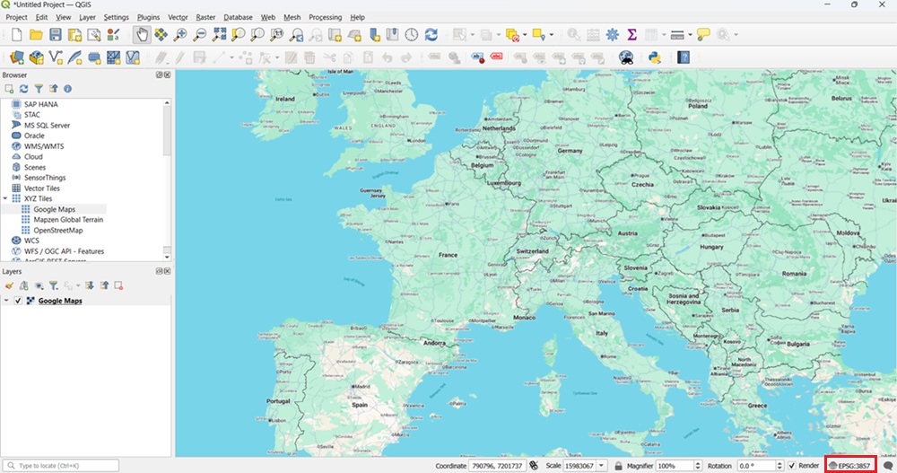
The default coordinate system in QGIS is EPSG:3857. If your cadastral map uses a different coordinate system, such as in our case — ETRS89/UTM — you should set the project CRS in QGIS to match the map’s CRS before working with it. This ensures that coordinates are read correctly and your measurements remain accurate. To do this, click the coordinate icon in the bottom-right corner of the QGIS window.
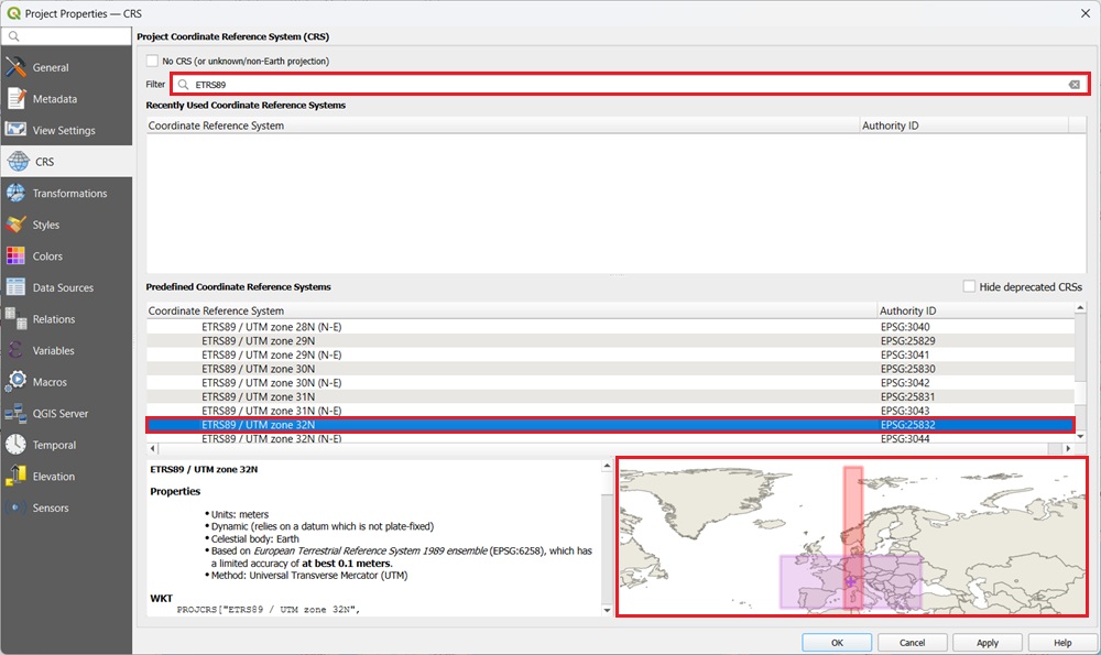
Enter your coordinate system into the filter and find the projected coordinate system that corresponds to your area. In our case it will correspone to EPSG25832 because we will survey in Adelsheim. Press Ok.
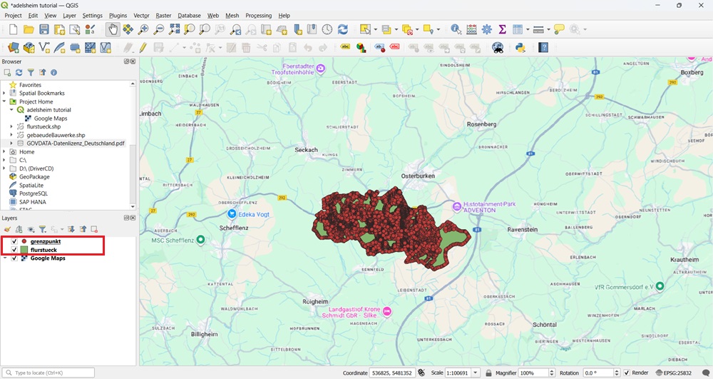
Drag and drop the shapefiles greenzpunkt.shp (which contains the land boundaries as lines) and flurstueck.shp (which contains the land corner points) into the Layers pane, similar how it was done before with the XYZ Tile..
Zoom in to ensure that both your field and your neighbor’s field are visible on the map.
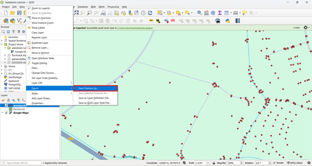
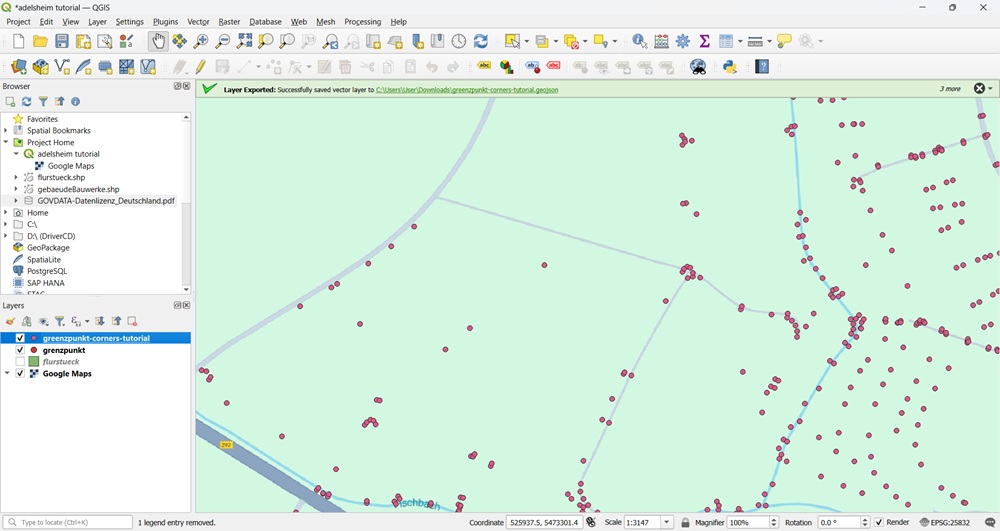
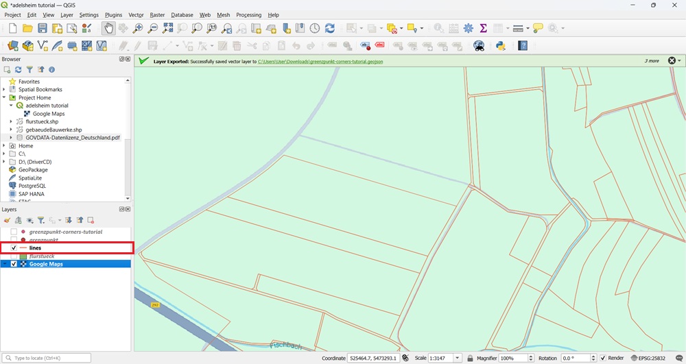
Click on layer which contain the land corners – flurstueck, choose Export->Save features as.
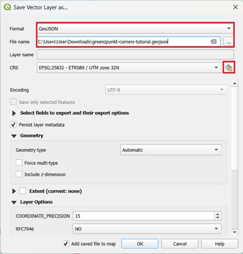
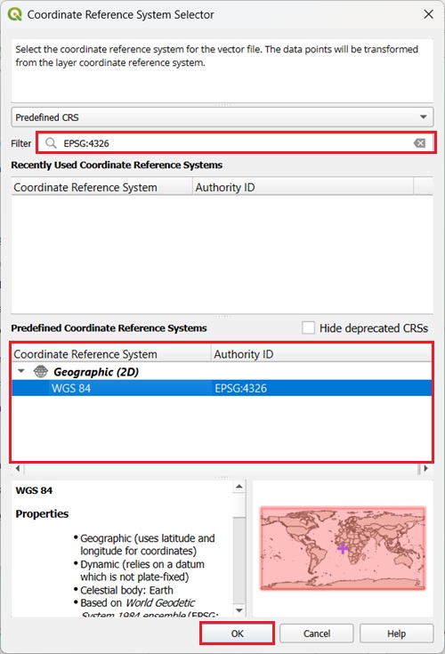
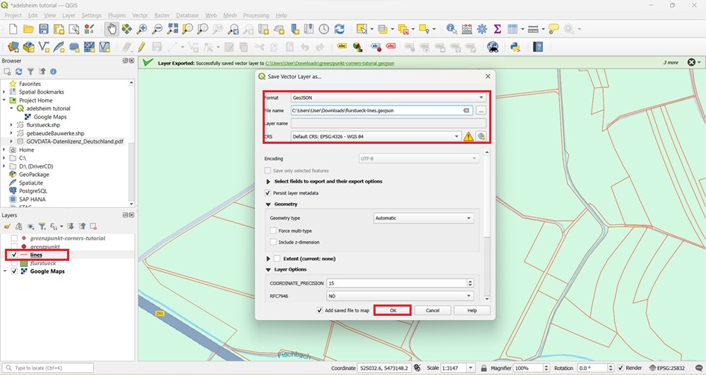
Choose GeoJSON as Format. Choose File name. Press icon of CRS.
Since we will work in SW Maps utilizes the WGS84 geographic coordinate system (EPSG:4326) for data recording and export, find WGS84 (EPSG:4326) and press OK.
Press Ok. The new layer will appear.
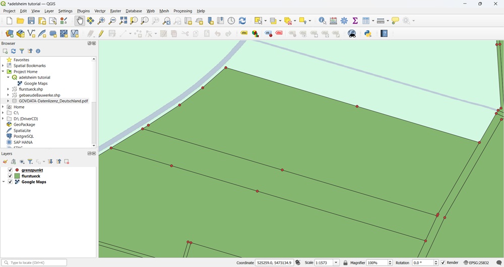
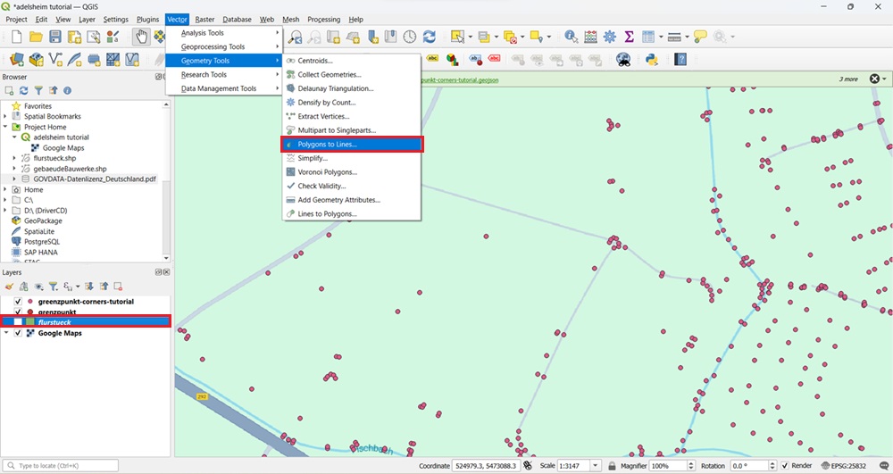
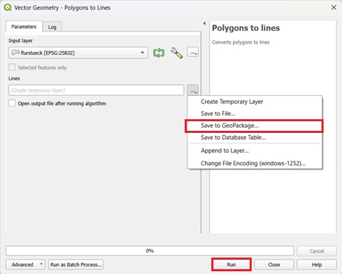
To export field boundaries, we will need transform polygon lines of flurstueck layer to lines before export. Go to Vector → Geometry Tools → Polygons to lines.
Save the result as a new layer and press Run.
A new layer with lines indicating boundaries of the field will apper.
Click at this new layer, choose Export->Save features as. Choose GeoJSON as Format. Choose File name. Choose WGS84 (EPSG:4326) at CRS. Press Ok.
Import boundary lines and points into SW Maps
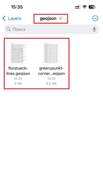
Transfer the exported files containing the land boundaries (lines) and corner points to your smartphone, and save them in the SW Maps/Layers/geojson folder.
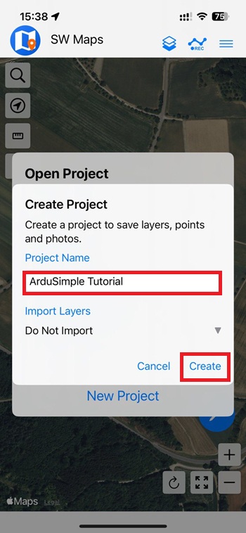
Open SW Maps on your phone. Create New Project.
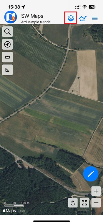
Tap on Layers icon.
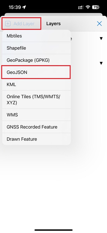
Press Add Layer and choose GeoJSON.
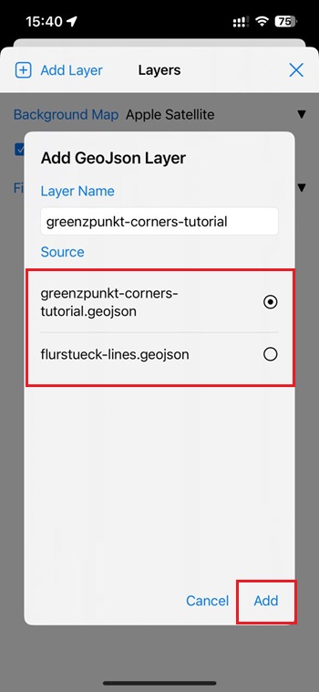
You will see your files in in the list. Add them one by one to your project. It may take several minutes to load the data from files.
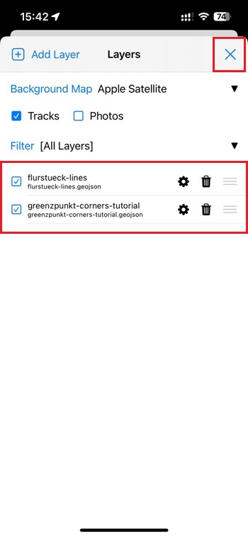
It may take several minutes to load the data from files. Press Close.
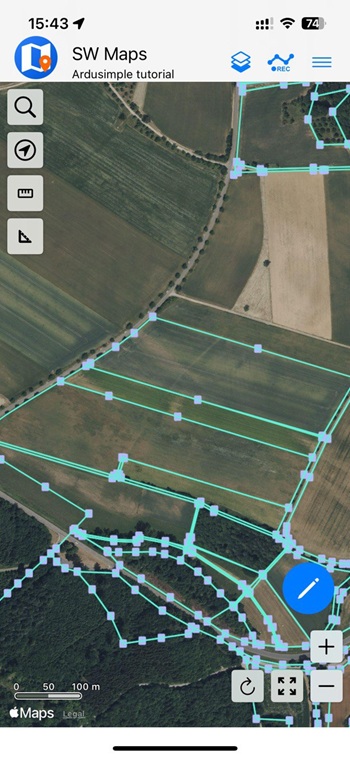
You will see your land corners and boundary lines on the map.
Connect the kit to NTRIP service
To achieve centimeter-level accuracy in your field measurements, you need to use RTK corrections. In this tutorial, we will get correction data from the Germany’s SAPOS NTRIP service, which has a calibrated base station located near our field. If you are located in Germany too, follow our tutorial how to register and access the SAPOS NTRIP service in Germany. If you’re located in a different country and need help finding an NTRIP correction service, see our List of RTK Correction Services in your Country. When choosing a NTRIP service, make sure it uses calibrated base stations. This is important for cadastral work, where absolute accuracy is required. Free services like RTK2GO are not suitable, as their base stations are often uncalibrated and only provide relative accuracy, which is not suitable for comparing with official cadastral data. Before going to the field, make sure that you have credentials to connect to NTRIP service, like: NTRIP Address, Port, Mount Point, Username, Password.
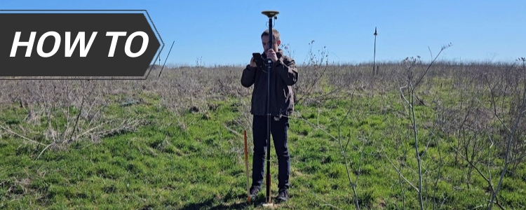
Now it is time to go to your field. To connect your RTK Calibrated Surveyor kit to your phone following its User Guide.
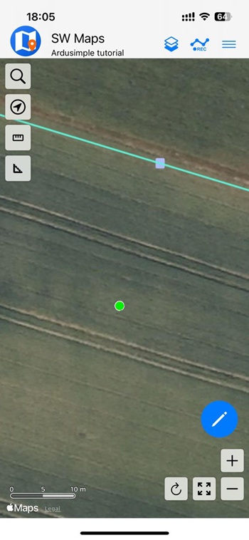
Connect your kit to your phone via BLE connection and connect to NTRIP service following its User guide. Once connected you will see a green dot on your screen indicating your position and RTK fix. This means you can start your survey work with centimeter level accuracy.
Staking out cadastral points
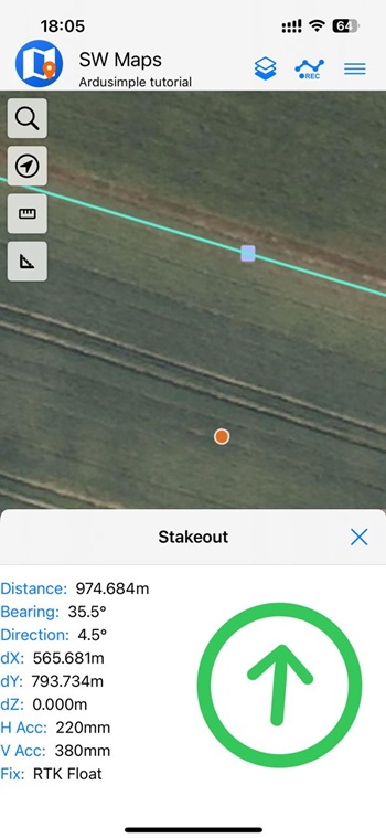
To start navigation to your boundary corner, click on the cadastral point. The app will guide you to it, showing distance and accuracy.
When the distance to the point is close to 1 centimeter and RTK Fix is active, you’re on the legal point. Compare its position to physical features (fence, wall, etc.). If there’s a mismatch, you have the data to talk with your neighbor confidently. For legal disputes, have a licensed surveyor confirm your findings.
If you want to follow this tutorial, we have all the products in stock and ready to be shipped:
 and
and  How to get a quotation