Knowing how many strawberries are growing in a field — and exactly where they are — is critical for farmers and researchers. It helps them plan harvest schedules, manage workers, and optimize production. Traditionally, this counting is done manually, which takes a lot of time and is often not very precise. Existing camera-based solutions are also limited: they may double-count fruits, miss strawberries hidden under leaves, or struggle to separate plants from the background.
A research team (Pardo-Beainy et al., 2025) set out to build a mobile, low-cost system that can detect, count, and locate each strawberry with centimeter accuracy in hydroponic rows.
The solution: Camera + GNSS RTK + AI system
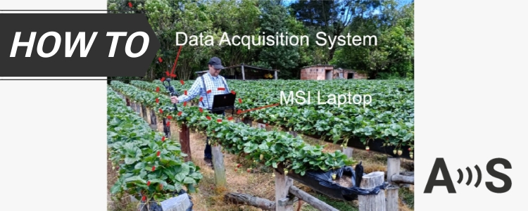
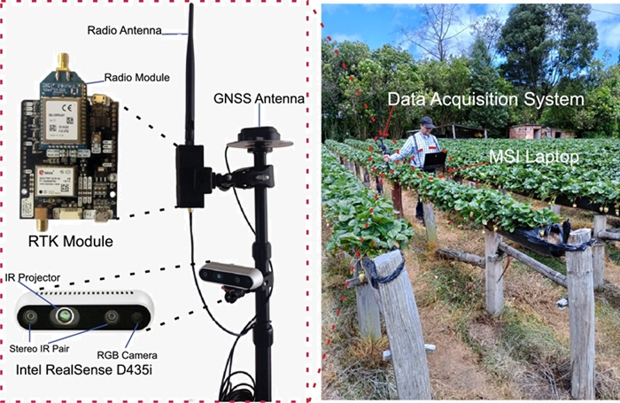
The researchers built a mobile data collection system that they could carry into any field:
RGB-D camera to capture normal color images + depth (distance to objects). This helps ignore everything in the background and focus only on the target row.
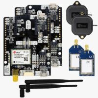
simpleRTK2B – Starter Kit LR for centimeter-level coordinates and time sync which means every strawberry detected gets an exact GPS position.
Computers (laptop and NVIDIA Jetson) running ROS + Python to process images and position data together.
Portable power + tripod/monopod for quick moves between plots.
Camera and RTK system are mounted on a monopod
How it works
The process is simple:
Take pictures: The camera captures images of the strawberries while walking along the rows.
Clean the images: The software removes background objects more than 1 meter away, so it only keeps the strawberries in the target row.
Detect and count: An AI model finds each strawberry, draws a box around it, and counts it once (no duplicates).
Add GPS position: The RTK system records the exact location of each image and attaches that data to every strawberry found.
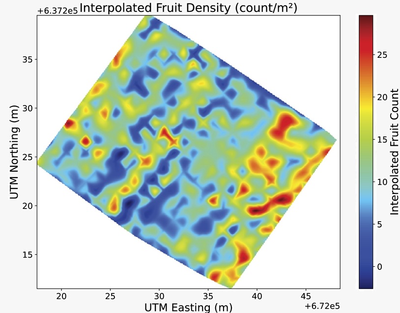
Create a yield map: The software combines everything into a digital map showing where strawberries are located and how many are in each square meter of the field.
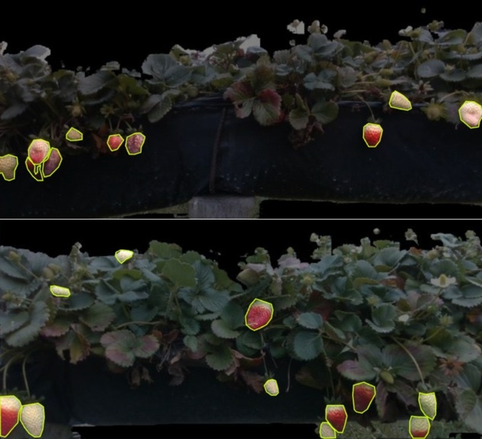
Images from the strawberry dataset with different light, angles, sizes, colors, and leaves partly covering the fruit
Fruit density map with areas with the highest concentration
Results: Precision yield maps
The system counted strawberries with over 99% accuracy compared to manual counting.
Each strawberry was placed on the map with centimeter precision.
Farmers could see hot spots and low-yield areas in their field on a color-coded map.
The whole system is portable – no fixed installation needed.
This allows farms and researchers to measure results faster, optimize irrigation and fertilizer use, and plan harvests more efficiently. Check full article here.
 and
and 
 Made in EuropeRTK starter kits