
 and
and 
How to export your control points to SW Maps and stake them out on the site
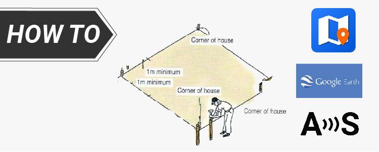
Have you done a survey of your land property to measure reference points, property boundaries, tree locations and designed the building for your site? Now, the next challenge arises: using your reliable RTK kit to accurately stake out the building corners on the site. Surveyed corners or control points create a consistent Coordinate system, crucial […]
How to export your control points to SW Maps and stake them out on the site Read More »