How GNSS RTK helps forestry machines drive stable on rough terrain


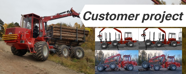
Researchers at Umeå University tested how RTK GNSS can support artificial intelligence (AI) control systems in large forestry machines (full article is available here). The goal was to check if a vehicle control system trained only in computer simulation could work directly on a real 31-ton forestry forwarder without further tuning — a process called simulation-to-reality transfer.
To do this safely and accurately, the team relied on centimeter-level positioning from RTK GNSS to measure how the real vehicle moved, compared to how it was expected to move in the virtual model.
RTK GNSS for Precision Vehicle Tracking in the Forest
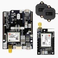
To evaluate the machine’s movement in real conditions, the forwarder was equipped with a dual-antenna simpleRTK2B Heading – Basic Starter Kit (u-blox ZED-F9P). This setup provided:
- 1-cm accuracy for vehicle position, even under light canopy,
- Heading and tilt information to study vehicle dynamics,
- Continuous data recording during driving tests on forest roads and uneven ground.
The RTK system created a precise 3-D record of how the machine moved, rolled, and leaned while crossing rough terrain — essential for verifying AI control performance.
Comparing real and simulated forest driving
In simulation, the AI learned to adjust hydraulic suspension and steering to keep the vehicle balanced.
When transferred to the real forwarder, the same AI controller used RTK GNSS feedback for evaluation.
Researchers compared:
- The measured motion from RTK GNSS sensors in the forest, and
- The predicted motion from the digital simulation.
The strong match between both datasets confirmed that the controller behaved correctly in real conditions.
Field results from the open-pit and forest tests
Tests showed that low-cost dual-antenna RTK GNSS can deliver reliable, centimeter-level motion data for heavy off-road machines. This accuracy made it possible to validate AI control systems without additional sensors or expensive geodetic equipment.
The combination of AI control and RTK GNSS monitoring improved stability and safety during forest operations.
Related products
If you are developing a autonomous forestry, agricultural, and mining machines, our RTK GNSS products provide the accuracy and reliability you need.
-
Sale!
 Made in EuropeRTK starter kits
simpleRTK2B Heading – Basic Starter Kit
From 414,00€ This product has multiple variants. The options may be chosen on the product page
 and
and 


